Rhondodendrons
Rhondodendrons is in Clapham cum Newby, Craven District, England. Rhondodendrons is situated nearby to Ingleborough Nature Trail, as well as near the waterfall Clapham Falls.| Tap on a place to explore it |
Places of Interest Nearby
Highlights include St James’ Church, Clapham and Ingleborough Cave.
St James’ Church, Clapham
Church
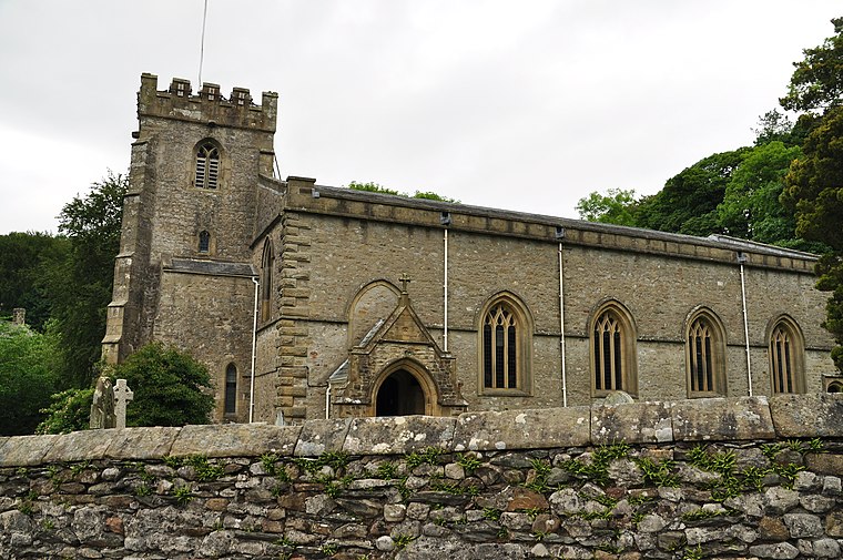
Photo: Nilfanion, CC BY-SA 4.0.
St James' Church is the parish church of Clapham, North Yorkshire, in England. The church was originally constructed in the 15th century. Other than the tower, it was rebuilt in 1814, and in 1899 a south porch was added and some of the windows were altered. St James’ Church, Clapham is situated 1,800 feet southwest of Rhondodendrons.
Ingleborough Cave
Cave

Photo: Peter Martin, CC BY-SA 2.0.
Ingleborough Cave is a show cave close to the village of Clapham in North Yorkshire, England, adjacent to where the water from Gaping Gill resurges. That part of the cave that is open to the public follows a fossil gallery for some 500 metres. Ingleborough Cave is situated 1 mile north of Rhondodendrons.
Brokken Bridge
Bridge

Photo: Michael Graham, CC BY-SA 2.0.
Brokken Bridge is situated 2,500 feet southwest of Rhondodendrons.
Places in the Area
Nearby places include Clapham and Wharfe.
Clapham

Photo: RobThinks, CC BY-SA 4.0.
Clapham is a village in the civil parish of Clapham cum Newby in North Yorkshire, England. It lies within the Yorkshire Dales National Park, 6 miles north-west of Settle, and just off the A65 road.
Wharfe
Hamlet
Photo: Kate Jewell, CC BY-SA 2.0.
Wharfe is a hamlet about a mile north east of the village of Austwick, North Yorkshire, England. Its postcode is LA2 8DQ. The name means 'The bend', The hamlet is the only settlement in Crummackdale, the upper valley of Austwick Beck. Wharfe is situated 2 miles east of Rhondodendrons.
Keasden
Hamlet

Photo: Wikimedia, CC BY-SA 2.0.
Keasden is a hamlet in the civil parish of Clapham-cum-Newby, in the county of North Yorkshire, in the north-western England. It is about 2 miles to the south west of the village of Clapham and about 5 miles to the east of Bentham. Keasden is situated 2½ miles southwest of Rhondodendrons.
Rhondodendrons
- Type: Sign
- Categories: information and tourism
- Location: Clapham cum Newby, Craven District, North Yorkshire, Yorkshire, England, United Kingdom, Britain and Ireland, Europe
- View on OpenStreetMap
Latitude
54.12353° or 54° 7′ 25″ northLongitude
-2.38425° or 2° 23′ 3″ westOpen location code
9C6V4JF8+C8OpenStreetMap ID
node 11061925570OpenStreetMap feature
tourism=information
This page is based on OpenStreetMap, Wikidata, and Wikimedia Commons.
We’d love your help improving our open data sources. Thank you for contributing.
Satellite Map
Discover Rhondodendrons from above in high-definition satellite imagery.
Notable Places Nearby
Highlights include Ingleborough Nature Trail and Clapham Falls.
Nearby Places
Explore places such as Geology and Nature.
North Yorkshire: Must-Visit Destinations
Delve into York, Middlesbrough, Harrogate, and Ripon.
Curious Places to Discover
Uncover intriguing places from every corner of the globe.
About Mapcarta. Data © OpenStreetMap contributors and available under the Open Database License". Text is available under the CC BY-SA 4.0 license, except for photos, directions, and the map. Photo: Michael Bryan, CC BY 2.0.