Lloma de Peres
Lloma de Peres is a peak in Pego, Alicante, Valencian Community and has an elevation of 348 metres. Lloma de Peres is situated nearby to the locality Lloma de Perdigó, as well as near Pujols.| Tap on a place to explore it |
Places of Interest
Highlights include Castell d’Ambra and Església de Sant Miquel Arcàngel de la Vall d’Ebo.

Església de Sant Miquel Arcàngel de la Vall d’Ebo
Church

Photo: Joanbanjo, CC BY-SA 3.0.
Església de Sant Miquel Arcàngel de la Vall d’Ebo is a church.

Places in the Area
Nearby places include Pego and La Vall d’Ebo.
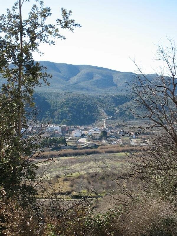
Pego
Town

Photo: Joanbanjo, CC BY-SA 3.0.
Pego is a municipality located in the province of Alicante, Spain. Lying just inland from the northern Costa Blanca resort of Dénia, the town of Pego sits in a depression, surrounded by mountains.
La Vall d’Ebo
Village
 La Vall d'Ebo is a municipality in the province of Alicante and autonomous community of Valencia, Spain. The municipality covers an area of 32.4 square kilometres and as of 2011 had a population of 284 people.
Tormos
Village

Photo: SEGARIA, CC BY-SA 3.0.
Tormos is a municipality in the province of Alicante and autonomous community of Valencia, Spain. The municipality covers an area of 5.3 square kilometres and as of 2011 had a population of 383 people.
Lloma de Peres
- Type: Peak with an elevation of 348 metres
- Category: landform
- Location: Pego, Alicante, Valencian Community, Eastern Spain, Spain, Iberia, Europe
- View on OpenStreetMap
Latitude
38.8253° or 38° 49′ 31″ northLongitude
-0.1325° or 0° 7′ 57″ westElevation
348 metres (1,142 feet)Open location code
8CCXRVG9+42OpenStreetMap ID
node 11077308946OpenStreetMap feature
natural=peak
This page is based on OpenStreetMap, Wikidata, and Wikimedia Commons.
We’d love your help improving our open data sources. Thank you for contributing.
Satellite Map
Discover Lloma de Peres from above in high-definition satellite imagery.
In Other Languages
“Lloma de Peres” goes by many names.
- Catalan: “Lloma de Peres”
Localities in the Area
Explore places such as Lloma de Perdigó and Pujols.
Notable Places Nearby
Highlights include Pego and el Xical.
Alicante: Must-Visit Destinations
Delve into Alicante, Elche, Benidorm, and Torrevieja.
Curious Peaks to Discover
Uncover intriguing peaks from every corner of the globe.
About Mapcarta. Data © OpenStreetMap contributors and available under the Open Database License". Text is available under the CC BY-SA 4.0 license, except for photos, directions, and the map. Photo: Poco a poco, CC BY 3.0.