Burbidge’s
Burbidge’s is a bakery in Andover, Test Valley District, England. Burbidge’s is situated nearby to Weyhill Road Post Office, as well as near Saint Andrews Church.| Tap on a place to explore it |
Places of Interest Nearby
Highlights include St Michael’s Church Of England and Andover railway station.
St Michael’s Church Of England
Church

Photo: Michael FORD, CC BY-SA 2.0.
St Michael’s Church Of England is situated 1,200 feet southeast of Burbidge’s.
Andover railway station
Railway station
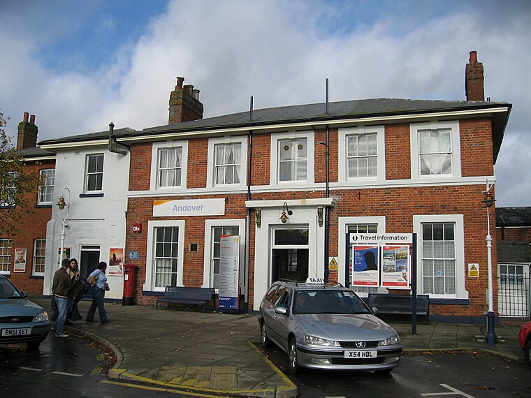
Photo: Wikimedia, Public domain.
Andover railway station serves the town of Andover, Hampshire, England. The station is served and operated by South Western Railway. It is 66 miles 19 chains down the line from London Waterloo on the West of England Main Line. Andover railway station is situated 3,200 feet east of Burbidge’s.
Andover War Memorial Hospital
Hospital

Photo: Wikimedia, CC BY-SA 2.0.
Andover War Memorial Hospital is a community hospital in Andover, Hampshire. The hospital provides inpatient rehabilitation, day hospital services, a minor injury unit and an outpatient unit. Andover War Memorial Hospital is situated 3,600 feet northeast of Burbidge’s.
Places in the Area
Nearby places include Foxcotte and Penton Corner.
Foxcotte
Suburb

Photo: Michael FORD, CC BY-SA 2.0.
Foxcotte is a small hamlet in the civil parish of Charlton in the Test Valley district of Hampshire, England. Its nearest town is Andover, which only lies approximately 1.7 miles south-east from the hamlet.
Penton Corner
Suburb

Photo: Chris Talbot, CC BY-SA 2.0.
Penton Corner is a hamlet in the civil parish of Penton Mewsey in the Test Valley district of Hampshire, England. Its nearest town is Andover, which lies approximately 2 miles east from the hamlet.
Anna Valley
Village

Photo: Chris Talbot, CC BY-SA 2.0.
Anna Valley is part of the village and parish of Upper Clatford, Hampshire, United Kingdom. The settlement is located approximately 1.0 mile south-west of the market town of Andover.
Burbidge’s
- Type: Bakery
- Wheelchair access: yes
- Categories: shop and food
- Location: Andover, Test Valley District, Hampshire, South East England, England, United Kingdom, Britain and Ireland, Europe
- View on OpenStreetMap
Latitude
51.20885° or 51° 12′ 32″ northLongitude
-1.50616° or 1° 30′ 22″ westOpen location code
9C3W6F5V+GGOpenStreetMap ID
node 1108731272OpenStreetMap feature
shop=bakeryOpenStreetMap attribute
wheelchair=yes
This page is based on OpenStreetMap, Wikidata, and Wikimedia Commons.
We’d love your help improving our open data sources. Thank you for contributing.
Satellite Map
Discover Burbidge’s from above in high-definition satellite imagery.
Notable Places Nearby
Highlights include Weyhill Road Post Office and Saint Andrews Church.
Nearby Places
Explore places such as McColls and St Andrews Church.
Hampshire: Must-Visit Destinations
Delve into Southampton, Portsmouth, Winchester, and Farnborough.
Curious Bakeries to Discover
Uncover intriguing bakeries from every corner of the globe.
About Mapcarta. Data © OpenStreetMap contributors and available under the Open Database License". Text is available under the CC BY-SA 4.0 license, except for photos, directions, and the map. Photo: Mike Cattell, CC BY 2.0.