Old Sacramento Candy Barrel
Old Sacramento Candy Barrel is a confectionery store in Sacramento County, Sacramento Valley, California. Old Sacramento Candy Barrel is situated nearby to California State Military Museum, as well as near the tourism office Visitors Center.| Tap on a place to explore it |
Places of Interest Nearby
Highlights include California State Military Museum and Golden 1 Center.
California State Military Museum
Museum

Photo: Isaac Crumm, Public domain.
The California State Military Museum was the official military museum of the State of California. It was located in the Old Sacramento State Historic Park at 1119 Second Street.
Golden 1 Center
Stadium

Photo: U.S. Department of Energy, Public domain.
Golden 1 Center is an indoor arena in downtown Sacramento, California, United States. It sits partially on the site of the former Downtown Plaza shopping center. Golden 1 Center is situated 1,800 feet southeast of Old Sacramento Candy Barrel.
Crocker Art Museum
Museum
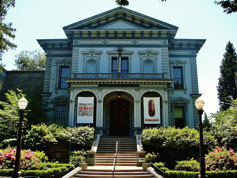
Photo: Amadscientist, CC BY 3.0.
The Crocker Art Museum is the oldest art museum in the Western United States, located in Sacramento, California. Founded in 1885, the museum holds one of the premier collections of Californian art. Crocker Art Museum is situated 1,800 feet south of Old Sacramento Candy Barrel.
Places in the Area
Nearby places include Sacramento and West Sacramento.
Sacramento
 Sacramento is the state capital of California in the United States. It is the regional center for the Greater Sacramento metropolitan area, which dominates much of the surrounding Sacramento Valley and stretches into parts of Gold Country.
West Sacramento

Photo: Wikimedia, Public domain.
West Sacramento is a city of 54,000 people in Yolo County in the Sacramento Valley of California. West Sacramento is on the west bank of the Sacramento River, opposite the city of Sacramento.
Curtis Park
Suburb
Curtis Park is a neighborhood located within the city of Sacramento, California. Curtis Park is defined as north of Sutterville Road, south of Broadway, east of Freeport Boulevard, and west of Highway 99. Curtis Park is situated 2½ miles southeast of Old Sacramento Candy Barrel.
Old Sacramento Candy Barrel
- Type: Confectionery store
- Categories: shop and food
- Location: Sacramento County, Sacramento Valley, California, United States, North America
- View on OpenStreetMap
Latitude
38.58206° or 38° 34′ 55″ northLongitude
-121.50514° or 121° 30′ 19″ westOpen location code
84CWHFJV+RWOpenStreetMap ID
node 11088652086OpenStreetMap feature
shop=confectionery
This page is based on OpenStreetMap, Wikidata, and Wikimedia Commons.
We’d love your help improving our open data sources. Thank you for contributing.
Satellite Map
Discover Old Sacramento Candy Barrel from above in high-definition satellite imagery.
Notable Places Nearby
Highlights include Central Pacific Freight Depot and Visitors Center.
Nearby Places
Explore places such as Cerealism and Flip Flop Shops & Shoes.
Sacramento County: Must-Visit Destinations
Delve into Sacramento, Elk Grove, Folsom, and Citrus Heights.
Curious Confectionery Stores to Discover
Uncover intriguing confectionery stores from every corner of the globe.
About Mapcarta. Data © OpenStreetMap contributors and available under the Open Database License". Text is available under the CC BY-SA 4.0 license, except for photos, directions, and the map. Photo: J.smith, CC BY-SA 3.0.