Croix Chidaine
Croix Chidaine is a wayside cross in Saint-Cyr-sur-Loire, Arrondissement of Tours, Centre-Val de Loire. Croix Chidaine is situated nearby to the park Le Bois Livère, as well as near Marais de Palluau.| Tap on a place to explore it |
Places of Interest Nearby
Highlights include Manoir de la Béchellerie and Château de Palluau.
Manoir de la Béchellerie
Castle

Photo: Wikimedia, Public domain.
Manoir de la Béchellerie is a castle, which is situated 1 km east of Croix Chidaine.
Château de Palluau
Manor estate

Photo: Wikimedia, Public domain.
Château de Palluau is a manor estate, which is situated 1¼ km southeast of Croix Chidaine.
Priory of St. Cosmas
Museum
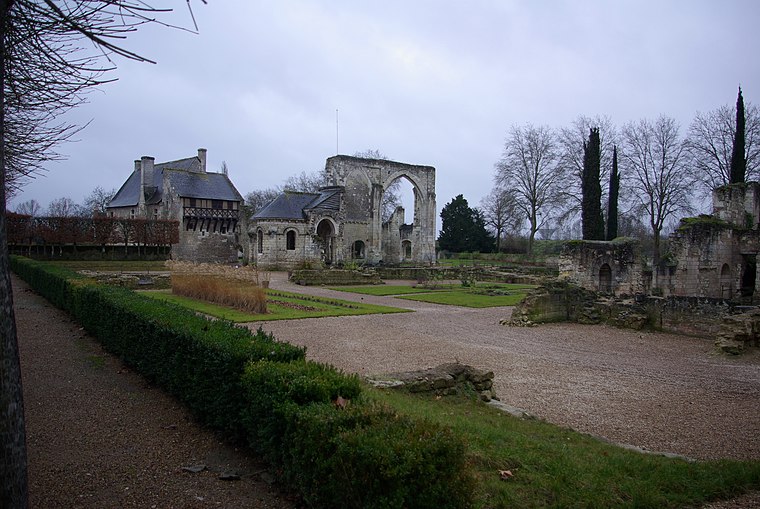
Photo: Duch.seb, CC BY-SA 3.0.
The Priory of St. Cosmas or the Priory of Ronsard is a former priory built upon an island in the river Loire at La Riche near Tours in Touraine, founded in the 11th century and dedicated to St. Priory of St. Cosmas is situated 2½ km south of Croix Chidaine.
Places in the Area
Nearby places include Tours and Sainte-Radegonde-en-Touraine.
Tours

Photo: Q3382841, Public domain.
Tours is the largest city in the region of Centre-Val de Loire, France. It is the prefecture of the department of Indre-et-Loire. The commune of Tours had 136,463 inhabitants as of 2018 while the population of the whole metropolitan area was 516,973.
Sainte-Radegonde-en-Touraine
Suburb

Photo: Guill37, Public domain.
Sainte-Radegonde-en-Touraine is a suburb, which is situated 5 km east of Croix Chidaine.
Sanitas
Suburb

Photo: Reuillois, CC BY-SA 3.0.
Sanitas is a suburb, which is situated 5 km southeast of Croix Chidaine.
Croix Chidaine
- Type: Wayside cross
- Denomination: Catholic
- Category: historic site
- Location: Saint-Cyr-sur-Loire, Arrondissement of Tours, Indre-et-Loire, Centre-Val de Loire, France, Europe
- View on OpenStreetMap
Latitude
47.41064° or 47° 24′ 38″ northLongitude
0.64409° or 0° 38′ 39″ eastOpen location code
8FV2CJ6V+7JOpenStreetMap ID
node 11098894817OpenStreetMap feature
historic=wayside_crossOpenStreetMap attribute
denomination=catholic
This page is based on OpenStreetMap, Wikidata, and Wikimedia Commons.
We’d love your help improving our open data sources. Thank you for contributing.
Satellite Map
Discover Croix Chidaine from above in high-definition satellite imagery.
Notable Places Nearby
Highlights include Le Bois Livère and Marais de Palluau.
Nearby Places
Explore places such as Manet and Haut Bourg.
Centre-Val de Loire: Must-Visit Destinations
Delve into Orléans, Tours, Chartres, and Bourges.
Curious Wayside Crosses to Discover
Uncover intriguing wayside crosses from every corner of the globe.
About Mapcarta. Data © OpenStreetMap contributors and available under the Open Database License". Text is available under the CC BY-SA 4.0 license, except for photos, directions, and the map. Photo: Popolon, CC BY-SA 3.0.