Network route map
Network route map is in Cromer, Norfolk Coast, England. Network route map is situated nearby to Cromer railway station, as well as near Cromer Fire Station.| Tap on a place to explore it |
Places of Interest Nearby
Highlights include Cromer railway station and Sandcliff Hotel.
Cromer railway station
Railway station

Photo: Whittlepedia, CC BY 3.0.
Cromer is a railway station which serves the coastal town of Cromer, in the English county of Norfolk. It is a stop on the Bittern Line between Norwich and Sheringham. The station is located 26 miles 52 chains down the line from Norwich.
Sandcliff Hotel
Hotel

Photo: Evelyn Simak, CC BY-SA 2.0.
The Sandcliff Hotel is an AA 3 star hotel located on the seafront in the English town of Cromer, within the county of Norfolk, United Kingdom. Sandcliff Hotel is situated 1,000 feet north of Network route map.
Cliftonville Hotel
Hotel
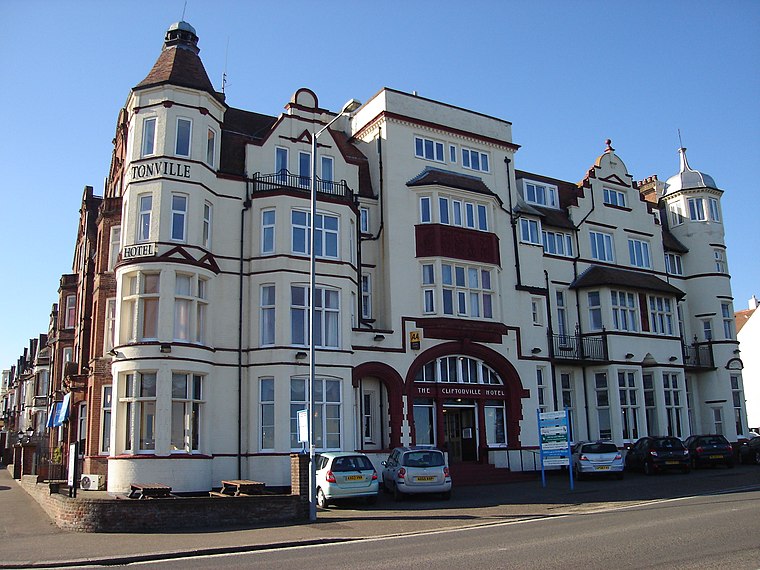
Photo: Northmetpit, Public domain.
The Cliftonville Hotel is an AA 3 star Hotel, and Grade II listed building, located in the English seaside town of Cromer in the county of Norfolk, United Kingdom. Cliftonville Hotel is situated 1,000 feet north of Network route map.
Places in the Area
Nearby places include East Runton and West Runton.
East Runton
Village

Photo: Northmetpit, Public domain.
East Runton is a village in the civil parish of Runton in the English county of Norfolk. East Runton is located 1.3 miles west of Cromer and 21.7 miles north of Norwich.
West Runton
Village

Photo: Evelyn Simak, CC BY-SA 2.0.
West Runton is a village in North Norfolk, England, on the North Sea coast. West Runton is situated 2 miles west of Network route map.
Northrepps
Village

Photo: Stavros1, Public domain.
Northrepps is a village and a civil parish in the English county of Norfolk. It is 3.4 miles southeast of Cromer, 22.2 miles north of Norwich and 137 miles north of London. Northrepps is situated 2½ miles southeast of Network route map.
Network route map
- Type: Map
- Categories: information and tourism
- Location: Cromer, Norfolk Coast, Norfolk, East of England, England, United Kingdom, Britain and Ireland, Europe
- View on OpenStreetMap
Latitude
52.93013° or 52° 55′ 49″ northLongitude
1.29251° or 1° 17′ 33″ eastOperator
Greater AngliaOpen location code
9F43W7JV+32OpenStreetMap ID
node 11107403700OpenStreetMap feature
tourism=information
This page is based on OpenStreetMap, Wikidata, and Wikimedia Commons.
We’d love your help improving our open data sources. Thank you for contributing.
Satellite Map
Discover Network route map from above in high-definition satellite imagery.
Places with the Same Name
Discover other places named “Network route map”.
Notable Places Nearby
Highlights include Cromer Fire Station and Cromer Methodist Church.
Nearby Places
Explore places such as Information and Tapi Carpets.
Norfolk: Must-Visit Destinations
Delve into Norwich, Great Yarmouth, King’s Lynn, and Norfolk Broads.
Curious Places to Discover
Uncover intriguing places from every corner of the globe.
About Mapcarta. Data © OpenStreetMap contributors and available under the Open Database License". Text is available under the CC BY-SA 4.0 license, except for photos, directions, and the map. Photo: Robert Powell, CC BY-SA 3.0.