Sand’Wraps
Sand’Wraps is a fast food restaurant in Anderlues, Arrondissement of Thuin, Wallonia. Sand’Wraps is situated nearby to the church Église Saint-Médard, as well as near the town hall Administration communale d’Anderlues.| Tap on a place to explore it |
Places of Interest Nearby
Highlights include Piéton railway station and Fontaine-l’Évêque Castle.
Piéton railway station
Railway station

Photo: Smiley.toerist, CC BY-SA 3.0.
Piéton railway station is situated 3½ km northeast of Sand’Wraps.
Fontaine-l’Évêque Castle
Public building
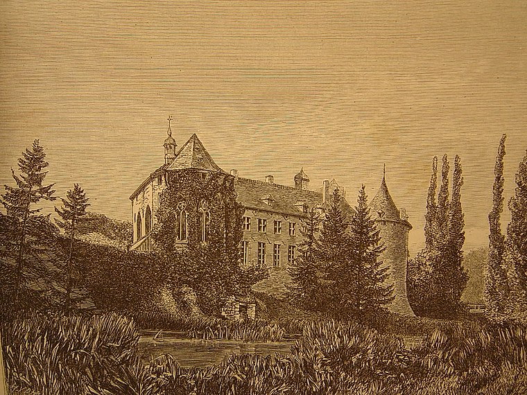
Photo: Wikimedia, Public domain.
Fontaine-l'Évêque Castle is a castle in Fontaine-l'Évêque, province of Hainaut, Wallonia, Belgium. Fontaine-l’Évêque Castle is situated 4 km east of Sand’Wraps.
Places in the Area
Nearby places include Mont-Sainte-Aldegonde and Fontaine-l’Évêque.
Mont-Sainte-Aldegonde
Village
Mont-Sainte-Aldegonde is a village of Wallonia and a district of the municipality of Morlanwelz, located in the province of Hainaut, Belgium. Mont-Sainte-Aldegonde is situated 3½ km northwest of Sand’Wraps.
Fontaine-l’Évêque
Town

Photo: Jean-Pol GRANDMONT, CC BY 2.5.
Fontaine-l'Évêque is a city and municipality of Wallonia located in the province of Hainaut, Belgium. On January 1, 2006, Fontaine-l'Évêque had a total population of 16,687. Fontaine-l’Évêque is situated 4 km east of Sand’Wraps.
Carnières
Village

Photo: Jean-Pol GRANDMONT, CC BY 3.0.
Carnières is a village, which is situated 4 km north of Sand’Wraps.
Sand’Wraps
- Type: Fast food restaurant
- Cuisine: sandwich
- Categories: food and restaurant
- Location: Anderlues, Arrondissement of Thuin, Hainaut, Wallonia, Belgium, Benelux, Europe
- View on OpenStreetMap
Latitude
50.40658° or 50° 24′ 24″ northLongitude
4.27044° or 4° 16′ 14″ eastOpen location code
9F26C74C+J5OpenStreetMap ID
node 11149808523OpenStreetMap feature
amenity=fast_foodOpenStreetMap attribute
cuisine=sandwich
This page is based on OpenStreetMap, Wikidata, and Wikimedia Commons.
We’d love your help improving our open data sources. Thank you for contributing.
Satellite Map
Discover Sand’Wraps from above in high-definition satellite imagery.
Notable Places Nearby
Highlights include Église Saint-Médard and Administration communale d’Anderlues.
Nearby Places
Explore places such as Elle & Lui and Pharmacie Bury.
Hainaut: Must-Visit Destinations
Delve into Charleroi, Mons, Tournai, and La Louvière.
Curious Fast Food Restaurants to Discover
Uncover intriguing fast food restaurants from every corner of the globe.
About Mapcarta. Data © OpenStreetMap contributors and available under the Open Database License". Text is available under the CC BY-SA 4.0 license, except for photos, directions, and the map. Photo: Jean-Pol GRANDMONT, CC BY-SA 3.0.