It’s A Man’s World
It’s A Man’s World is a hairdresser in Mönchengladbach, Düsseldorf, North Rhine-Westphalia. It’s A Man’s World is situated nearby to the health club Terra Sports, as well as near the government office WFMG.| Tap on a place to explore it |
Places of Interest Nearby
Highlights include Mönchengladbach Hauptbahnhof and Minto.
Mönchengladbach Hauptbahnhof
Railway station
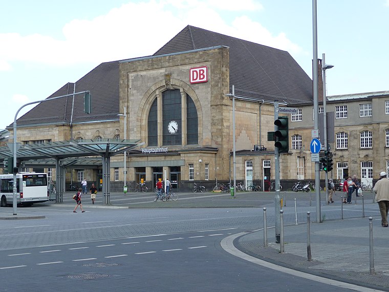
Photo: Thalan, CC BY-SA 3.0.
Mönchengladbach Hauptbahnhof is a railway station in the city of Mönchengladbach in western Germany. Mönchengladbach Hauptbahnhof is situated 300 metres east of It’s A Man’s World.
Minto
Shopping center

Photo: Wikimedia, CC BY-SA 3.0 de.
Minto is a shopping center, which is situated 260 metres southwest of It’s A Man’s World.
Abteiberg Museum
Museum
Photo: Hps-poll, CC BY-SA 3.0.
Museum Abteiberg is a municipal museum for contemporary art in the German city Mönchengladbach. Since the 1970s, the museum has been known for its experimental and avant-garde exhibitions, starting with director Johannes Cladders, and also its museum architecture, designed by Austrian architect Hans Hollein – a highpoint of postmodern design. Abteiberg Museum is situated 670 metres southwest of It’s A Man’s World.
Places in the Area
Nearby places include Am Wasserturm and Lürrip.

Lürrip
Neighborhood

Photo: Chris06, CC BY-SA 4.0.
Lürrip is a neighborhood, which is situated 2½ km east of It’s A Man’s World.
Lockhütte
Neighborhood
 Lockhütte is a neighborhood, which is situated 4 km north of It’s A Man’s World.
It’s A Man’s World
- Type: Hairdresser
- Category: shop
- Location: Mönchengladbach, Düsseldorf, Lower Rhine, North Rhine-Westphalia, Germany, Central Europe, Europe
- View on OpenStreetMap
Latitude
51.19647° or 51° 11′ 47″ northLongitude
6.44115° or 6° 26′ 28″ eastOpen location code
9F385CWR+HFOpenStreetMap ID
node 11208682568OpenStreetMap feature
shop=hairdresser
This page is based on OpenStreetMap, Wikidata, and Wikimedia Commons.
We’d love your help improving our open data sources. Thank you for contributing.
Satellite Map
Discover It’s A Man’s World from above in high-definition satellite imagery.
Places with the Same Name
Discover other places named “It’s A Man’s World”.
Notable Places Nearby
Highlights include Terra Sports and WFMG.
Nearby Places
Explore places such as HN Nails and Spa and Bar & Bar.
Lower Rhine: Must-Visit Destinations
Delve into Düsseldorf, Krefeld, Neuss, and Kleve.
Curious Hairdressers to Discover
Uncover intriguing hairdressers from every corner of the globe.
About Mapcarta. Data © OpenStreetMap contributors and available under the Open Database License". Text is available under the CC BY-SA 4.0 license, except for photos, directions, and the map. Photo: CaS2000, CC BY-SA 3.0 de.