Rustons
Rustons is a café in Mundesley, Norfolk Coast, England which is located on Station Road. Rustons is situated nearby to the tourism office Mundesley Visitor & Advice Centre, as well as near the government office Mundesley Parish Council.| Tap on a place to explore it |
- Type: Café
- Also known as: “The Porthole”
- Address: 5-7 Station Road, Mundesley
Places of Interest Nearby
Highlights include Church of All Saints and Church of St Margaret.
Church of All Saints
Church

Photo: Creative Commons, CC BY-SA 4.0.
Church of All Saints is situated 1,300 feet north of Rustons.
Church of St Margaret
Church

Photo: John Salmon, CC BY-SA 2.0.
Church of St Margaret is situated 1½ miles southeast of Rustons.
Church of St Peter and St Paul
Church

Photo: Helen Hanley, CC BY-SA 2.0.
Church of St Peter and St Paul is situated 1½ miles south of Rustons.
Places in the Area
Nearby places include Knapton and Trunch.
Knapton
Village
Photo: Helen Hanley, CC BY-SA 2.0.
Knapton is a village and civil parish in the English county of Norfolk. Knapton is located 8.9 miles south-east of Cromer and 19.4 miles north-east of Norwich, along the B1145. Knapton is situated 1½ miles south of Rustons.
Trunch
Village
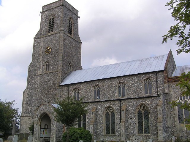
Photo: Helen Hanley, CC BY-SA 2.0.
Trunch is a village and parish in Norfolk, England, situated three miles north of North Walsham and two miles from the coast at Mundesley. At the Census 2011 the village had a population of 909. Trunch is situated 2 miles southwest of Rustons.
Edingthorpe
Village

Photo: Pommes104, CC BY-SA 3.0.
Edingthorpe is a small village and former civil parish, now in the parish of Bacton, in the North Norfolk district, of the English county of Norfolk. The village is located 10 miles south-east of Cromer and 18 miles north-east of Norwich. Edingthorpe is situated 2½ miles south of Rustons.
Rustons
Latitude
52.87674° or 52° 52′ 36″ northLongitude
1.43357° or 1° 26′ 1″ eastOpen location code
9F43VCGM+MCOpenStreetMap ID
node 11217366954OpenStreetMap feature
amenity=cafe
This page is based on OpenStreetMap, Wikidata, and Wikimedia Commons.
We’d love your help improving our open data sources. Thank you for contributing.
Satellite Map
Discover Rustons from above in high-definition satellite imagery.
Notable Places Nearby
Highlights include Mundesley Visitor & Advice Centre and Mundesley Parish Council.
Nearby Places
Explore places such as Craft Bakery and Jupe.
Norfolk: Must-Visit Destinations
Delve into Norwich, King’s Lynn, Great Yarmouth, and Norfolk Broads.
Curious Cafés to Discover
Uncover intriguing cafés from every corner of the globe.
About Mapcarta. Data © OpenStreetMap contributors and available under the Open Database License". Text is available under the CC BY-SA 4.0 license, except for photos, directions, and the map. Photo: Mike Hudson, CC BY-SA 3.0.