Cas Chilled
Cas Chilled is an office in North East Lincolnshire, England which is located on Poplar Road Business Units. Cas Chilled is situated nearby to Cleethorpes Fire Station, as well as near Christ Church.| Tap on a place to explore it |
- Opening hours:
Monday—Friday: 9:00 AM—5:00 PM
Saturday—Sunday: closed - Email: info@caschilled.co.uk
- Type: Office
- Address: Poplar Road Business Units, Cleethorpes, DN35 8BL
Places of Interest Nearby
Highlights include Cleethorpes railway station and Christ Church.
Cleethorpes railway station
Railway station
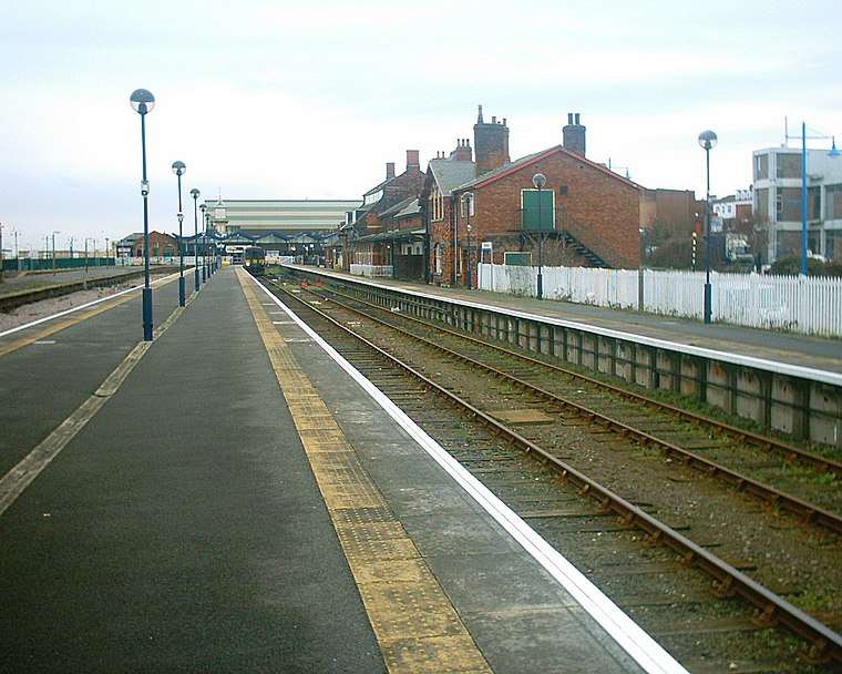
Photo: Captain Scarlet, CC BY 2.5.
Cleethorpes railway station is a railway station serving the seaside town of Cleethorpes in Lincolnshire, England. The station is managed by TransPennine Express, with East Midlands Railway and Northern Services also using the station. Cleethorpes railway station is situated 980 feet east of Cas Chilled.
Christ Church
Church

Photo: Rept0n1x, CC BY-SA 3.0.
Christ Church is situated 810 feet west of Cas Chilled.
Blundell Park
Stadium
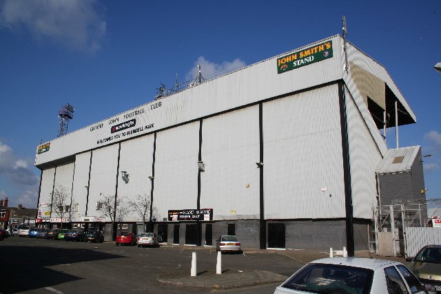
Photo: Richard Croft, CC BY-SA 2.0.
Blundell Park is a football ground in Cleethorpes, North East Lincolnshire, England and home to Grimsby Town Football Club. The stadium was built in 1899, but only one of the original stands remains. Blundell Park is situated 3,700 feet northwest of Cas Chilled.
Places in the Area
Nearby places include Cleethorpes and Old Clee.
Cleethorpes

Photo: Jpacarter, CC BY-SA 3.0.
Cleethorpes is a seaside resort on the Lincolnshire coast of England, south bank of the estuary of the River Humber, with a population in 2021 of 30,000.
Old Clee
Village
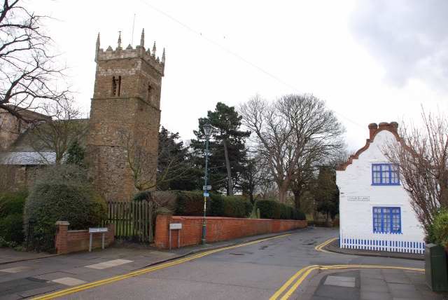
Photo: Allan chapman, CC BY-SA 2.0.
Old Clee is located in the Clee Road and Carr Lane area of eastern Grimsby, North East Lincolnshire, England, and adjoins the neighbouring town of Cleethorpes, to which it has historic links.
Grimsby

Photo: Gunnar Larsson, CC BY-SA 3.0.
Grimsby is a fishing port in Lincolnshire, standing on the south bank of the mouth of the River Humber, with a population in 2021 of 86,000. It merges into the seaside town of Cleethorpes, and this conurbation and rural hinterland comprise the unitary Local Authority of North East Lincolnshire, also called Great Grimsby.
Cas Chilled
Latitude
53.56302° or 53° 33′ 47″ northLongitude
-0.03461° or 0° 2′ 5″ westOpen location code
9C5XHX78+65OpenStreetMap ID
node 11217377818OpenStreetMap feature
office=courier
This page is based on OpenStreetMap, Wikidata, and Wikimedia Commons.
We’d love your help improving our open data sources. Thank you for contributing.
Satellite Map
Discover Cas Chilled from above in high-definition satellite imagery.
Notable Places Nearby
Highlights include Cleethorpes Fire Station and Beaconthorpe Methodist Church.
Nearby Places
Explore places such as ICF (Grimsby) Ltd and Ultrasonics Flight Cases.
England: Must-Visit Destinations
Delve into London, Manchester, Sheffield, and Leeds.
Curious Offices to Discover
Uncover intriguing offices from every corner of the globe.
About Mapcarta. Data © OpenStreetMap contributors and available under the Open Database License". Text is available under the CC BY-SA 4.0 license, except for photos, directions, and the map. Photo: sidibousaid, CC BY 2.0.