Label’ge Frite
Label’ge Frite is a fast food restaurant in Paris, Île-de-France. Label’ge Frite is situated nearby to the art gallery Carré d’Artistes - L’Expo, as well as near Palmer.| Tap on a place to explore it |
- Opening hours: 11:00 AM—10:00 PM and Friday—Saturday 11:00 AM—11:00 PM and Monday closed
- Type: Fast food restaurant
- Cuisine: burger
Places of Interest Nearby
Highlights include Notre Dame de Paris and Île de la Cité.
Notre Dame de Paris
Church
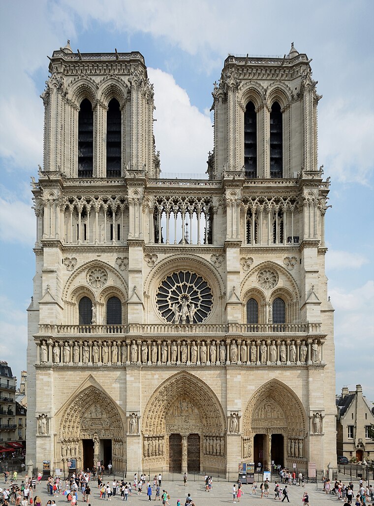
Photo: P e z i, CC BY-SA 3.0.
Notre-Dame de Paris, often referred to simply as Notre-Dame, is a medieval Catholic cathedral on the Île de la Cité, in the 4th arrondissement of Paris, France. Notre Dame de Paris is situated 720 metres east of Label’ge Frite.
Île de la Cité
Islet

Photo: David.Monniaux, CC BY-SA 3.0.
The Île de la Cité is one of the two natural islands on the Seine River in central Paris. It spans 22.5 hectares of land. In the 4th century, it was the site of the fortress of the area governor for the Roman Empire.
Orsay Museum
Museum

Photo: DXR, CC BY-SA 3.0.
The Musée d'Orsay is a museum in Paris, France, on the Left Bank of the Seine. It is housed in the former Gare d'Orsay, a Beaux-Arts railway station built from 1898 to 1900. Orsay Museum is situated 1¼ km northwest of Label’ge Frite.
Places in the Area
Nearby places include Saint-Germain-des-Prés and Left Bank.
Saint-Germain-des-Prés
Suburb

Photo: DXR, CC BY-SA 3.0.
Saint-Germain-des-Prés is one of the four administrative quarters of the 6th arrondissement of Paris, France, located around the church of the former Abbey of Saint-Germain-des-Prés.
Left Bank

Photo: Guilhem Vellut, CC BY 2.0.
The Left Bank in travellers' terms generally refers to the "Left Bank" of the River Seine in the French capital city of Paris. The Left Bank defies precise definition but generally refers to those arrondissements on the southern bank of the river as it flows…
Latin Quarter
Suburb

Photo: David.Monniaux, CC BY-SA 3.0.
The Latin Quarter of Paris is a district in Paris on the left bank of the Seine, around the Sorbonne. Located in the city's 5th and the 6th arrondissements, it is known for its concentration of universities.
Label’ge Frite
- Categories: food and restaurant
- Location: Paris, Île-de-France, France, Europe
- View on OpenStreetMap
Latitude
48.85352° or 48° 51′ 13″ northLongitude
2.34003° or 2° 20′ 24″ eastOpen location code
8FW4V83R+C2OpenStreetMap ID
node 11248608502OpenStreetMap feature
amenity=fast_foodOpenStreetMap attribute
cuisine=burger
This page is based on OpenStreetMap, Wikidata, and Wikimedia Commons.
We’d love your help improving our open data sources. Thank you for contributing.
Satellite Map
Discover Label’ge Frite from above in high-definition satellite imagery.
Places with the Same Name
Discover other places named “Label’ge Frite”.
Notable Places Nearby
Highlights include Carré d’Artistes - L’Expo and Palmer.
Nearby Places
Explore places such as Le Colvert and Next-Stop.
Paris: Must-Visit Destinations
Delve into La Défense, 1st arrondissement, 7th arrondissement, and 8th arrondissement.
Curious Fast Food Restaurants to Discover
Uncover intriguing fast food restaurants from every corner of the globe.
About Mapcarta. Data © OpenStreetMap contributors and available under the Open Database License". Text is available under the CC BY-SA 4.0 license, except for photos, directions, and the map. Photo: Benh, CC BY-SA 4.0.