Escuela de Lenguaje Namaste
Escuela de Lenguaje Namaste is a school in O’Higgins Region, Chile. Escuela de Lenguaje Namaste is situated nearby to the park Plaza Investigaciones de Chile, as well as near Plaza de juegos.| Tap on a place to explore it |
Places of Interest Nearby
Highlights include Estadio El Teniente and Centro Deportivo Patricio Mekis.
Estadio El Teniente
Stadium

Photo: Marco Antonio Correa Flores, CC BY-SA 4.0.
Estadio El Teniente, also known as Estadio Codelco El Teniente for sponsorship reasons, is a multi-purpose stadium in Rancagua, Chile. It is currently used mostly for football matches. Estadio El Teniente is situated 3 km south of Escuela de Lenguaje Namaste.
Centro Deportivo Patricio Mekis
Sports venue

Photo: Benjaminpvera, CC BY-SA 4.0.
Centro Deportivo Patricio Mekis is a sports venue, which is situated 1¼ km southwest of Escuela de Lenguaje Namaste.
Rancagua Regional Hospital
Hospital
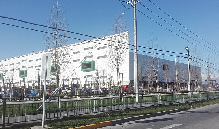
Photo: Warko, CC BY-SA 4.0.
Rancagua Regional Hospital is situated 3 km west of Escuela de Lenguaje Namaste.
Places in the Area
Nearby places include Rancagua and Chancón.
Rancagua

Photo: Marco Antonio Correa Flores, CC BY-SA 4.0.
Rancagua is a city in the O'Higgins Region. It is somewhat of a tourist destination, though largely because of the vineyards that have been developed in the surrounding area. Rancagua also offers sports centers and easy access to smaller villages and towns.
Chancón
Hamlet

Photo: R.A.T.P., CC BY-SA 3.0.
Chancón is a hamlet, which is situated 9 km northwest of Escuela de Lenguaje Namaste.
Machalí
Town

Photo: Penarc, CC BY-SA 3.0.
Machalí is a Chilean commune and city in Cachapoal Province, O'Higgins Region. Machalí is situated 9 km southeast of Escuela de Lenguaje Namaste.
Escuela de Lenguaje Namaste
- Type: School
- Category: education
- Location: O’Higgins Region, Chile, South America
- View on OpenStreetMap
Latitude
-34.14869° or 34° 8′ 55″ southLongitude
-70.73661° or 70° 44′ 12″ westOpen location code
47QFV727+G9OpenStreetMap ID
node 11248762529OpenStreetMap feature
amenity=school
This page is based on OpenStreetMap, Wikidata, and Wikimedia Commons.
We’d love your help improving our open data sources. Thank you for contributing.
Satellite Map
Discover Escuela de Lenguaje Namaste from above in high-definition satellite imagery.
Notable Places Nearby
Highlights include Plaza Investigaciones de Chile and Plaza de juegos.
Nearby Places
Explore places such as Jin Fu Sheng and Escuela de Lenguaje Didaskalos.
Chile: Must-Visit Destinations
Delve into Central Chile, Santiago, Valparaíso, and Concepción.
Curious Places to Discover
Uncover intriguing places from every corner of the globe.
About Mapcarta. Data © OpenStreetMap contributors and available under the Open Database License". Text is available under the CC BY-SA 4.0 license, except for photos, directions, and the map. Photo: Marco Antonio Correa Flores, CC BY-SA 4.0.