La Panoya
La Panoya is a restaurant in Oviedo, Asturias. La Panoya is situated nearby to the hospital Entrada Oncología Radioterápica, as well as near the heliport Helipuerto del HUCA.| Tap on a place to explore it |
Places of Interest Nearby
Highlights include Fountain of the Cuatro Caños and La Corredoria train station.
Fountain of the Cuatro Caños
Historic site

Photo: LMLM, CC BY-SA 4.0.
Fountain of the Cuatro Caños is a historic site, which is situated 770 metres northeast of La Panoya.
La Corredoria train station
Railway station

Photo: LMLM, CC BY-SA 4.0.
La Corredoria train station is a railway station, which is situated 1 km north of La Panoya.
La Foncalada
Archaeological site
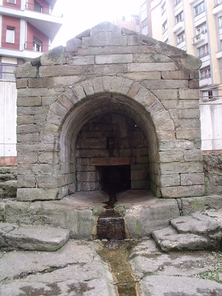
Photo: 19Tarrestnom65, CC BY-SA 4.0.
The Foncalada is a fountain of potable water located outside the city walls of Oviedo, Asturias, Spain; it was built by king Alfonso III of Asturias in the 9th century. La Foncalada is situated 2 km southwest of La Panoya.
Places in the Area
Nearby places include Colloto and La Covadonga.
Colloto
Suburb
Colloto is a place in the municipalities of Oviedo and Siero, Asturias, Spain. It is 5 kilometres from the city of Oviedo. Colloto is situated 2½ km east of La Panoya.
La Covadonga
Hamlet

Photo: Omarete, CC BY-SA 4.0.
La Covadonga is a hamlet, which is situated 3½ km south of La Panoya.

La Panoya
- Type: Restaurant
- Cuisine: regional
- Category: food
- Location: Oviedo, Asturias, Green Spain, Spain, Iberia, Europe
- View on OpenStreetMap
Latitude
43.37885° or 43° 22′ 44″ northLongitude
-5.83044° or 5° 49′ 50″ westOpen location code
8CMP95H9+GROpenStreetMap ID
node 11265111077OpenStreetMap feature
amenity=restaurantOpenStreetMap attribute
cuisine=regional
This page is based on OpenStreetMap, Wikidata, and Wikimedia Commons.
We’d love your help improving our open data sources. Thank you for contributing.
Satellite Map
Discover La Panoya from above in high-definition satellite imagery.
Places with the Same Name
Discover other places named “La Panoya”.
Notable Places Nearby
Highlights include Entrada Oncología Radioterápica and Helipuerto del HUCA.
Nearby Places
Explore places such as Astur Ocasión del Automóvil and Escuela Infantil Chiquitín.
Asturias: Must-Visit Destinations
Delve into Gijón, Villaviciosa, Grado, and Salas.
Curious Restaurants to Discover
Uncover intriguing restaurants from every corner of the globe.
About Mapcarta. Data © OpenStreetMap contributors and available under the Open Database License". Text is available under the CC BY-SA 4.0 license, except for photos, directions, and the map. Photo: Wikimedia, CC0.