Marin Health Urgent Care
Marin Health Urgent Care is a clinic in Marin County, California which is located on Civic Center Drive. Marin Health Urgent Care is situated nearby to Mount Olivet Cemetery, as well as near the railway station Marin Civic Center station.| Tap on a place to explore it |
Places of Interest Nearby
Highlights include Marin Civic Center station and Marin County Civic Center.
Marin Civic Center station
Railway station

Photo: Pi.1415926535, CC BY-SA 3.0.
Marin Civic Center station is a Sonoma–Marin Area Rail Transit station in San Rafael, California, located adjacent to the Marin County Civic Center. Marin Civic Center station is situated 1,100 feet south of Marin Health Urgent Care.
Marin County Civic Center
Public building
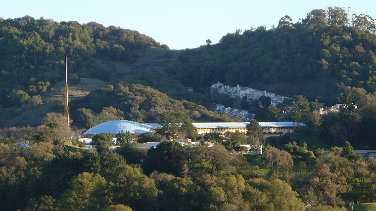
Photo: Fizbin, Public domain.
The Marin County Civic Center, designed by Frank Lloyd Wright, is located in San Rafael, California, the county seat of Marin County, California, United States. Marin County Civic Center is situated 3,100 feet southeast of Marin Health Urgent Care.
Mark Day School
School
San Rafael is a city in and the county seat of Marin County, California, United States. The city is located in the North Bay region of the San Francisco Bay Area. Mark Day School is situated 1 mile west of Marin Health Urgent Care.
Places in the Area
Nearby places include Terra Linda and Los Ranchitos.
Terra Linda
Neighborhood
 Terra Linda is a district of the city of San Rafael, California. It was formerly an unincorporated community within Marin County. It lies at an elevation of 171 feet.
Los Ranchitos
Hamlet
Los Ranchitos is an unincorporated community in Marin County, California, United States. It lies at an elevation of 66 feet. Los Ranchitos was developed in 1949 into lots of at least one acre in size, with most averaging 1-2 acres.
Santa Venetia
Hamlet

Photo: Kpapai, CC BY-SA 3.0.
Santa Venetia is a census-designated place in Marin County, California, United States. It is located 1.5 miles north of downtown San Rafael, at an elevation of 56 feet. The population was 4,289 at the 2020 census.
Marin Health Urgent Care
- Type: Clinic
- Address: 206, 4000 Civic Center Drive, San Rafael, CA 94903
- Category: health care
- Location: Marin County, California, United States, North America
- View on OpenStreetMap
Latitude
38.00433° or 38° 0′ 16″ northLongitude
-122.53814° or 122° 32′ 17″ westOpen location code
84CV2F36+PPOpenStreetMap ID
node 11294510565OpenStreetMap feature
amenity=clinicOpenStreetMap feature
healthcare=clinic
This page is based on OpenStreetMap, Wikidata, and Wikimedia Commons.
We’d love your help improving our open data sources. Thank you for contributing.
Satellite Map
Discover Marin Health Urgent Care from above in high-definition satellite imagery.
Notable Places Nearby
Highlights include Mount Olivet Cemetery and Terra Linda Bus Pad.
Nearby Places
Explore places such as Clear Design and Build and E.R.S. Immigration Services.
Marin County: Must-Visit Destinations
Delve into Tiburon, Sausalito, San Rafael, and Novato.
Curious Clinics to Discover
Uncover intriguing clinics from every corner of the globe.
About Mapcarta. Data © OpenStreetMap contributors and available under the Open Database License". Text is available under the CC BY-SA 4.0 license, except for photos, directions, and the map. Photo: Sanfranman59, CC BY-SA 3.0.