Tecchia nord dei tanoni
Tecchia nord dei tanoni is a cave in Fabbriche di Vergemoli, Lucca, Tuscany. Tecchia nord dei tanoni is situated nearby to the cave Tecchia sud dei tanoni, as well as near the ruins Ruderi Case Pitoncino.| Tap on a place to explore it |
Places of Interest Nearby
Highlights include Grotta del Vento and Monte Forato.
Grotta del Vento
Cave
 Grotta del Vento is a cave, which is situated 1¼ km northeast of Tecchia nord dei tanoni.
Monte Forato
Peak
 Monte Forato is a mountain in the Alpi Apuane, in Tuscany, central Italy. It is formed by two peaks of similar altitude, connected by a natural arch which has given the group its name.
Pania della Croce
Peak
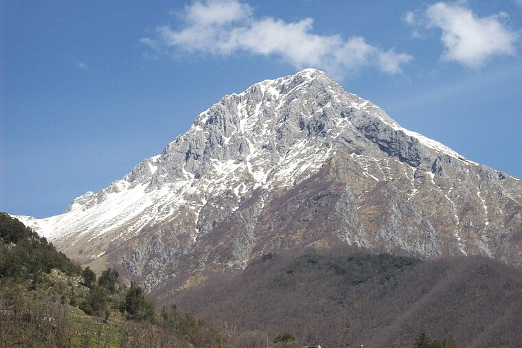
Photo: Vergaglia, Public domain.
Pania della Croce is a mountain in the Alpi Apuane, in Tuscany, central Italy. It is the highest peak in the Panie Group, located not far from the Tyrrhenian Sea coast.
Places in the Area
Nearby places include Fornovolasco and Cardoso.

Cardoso
Locality
 Cardoso is a locality, which is situated 3 km southwest of Tecchia nord dei tanoni.
San Pellegrinetto
Hamlet

Photo: O Correto, CC BY-SA 4.0.
San Pellegrinetto was an Italian comune in the Alps of Garfagnana, a historic region of Tuscany, province of Lucca. It was dependent for many years on the comune of Trassilico, time during which it adopted the name Alpe di Trassilico until the creation of its parish. San Pellegrinetto is situated 3 km east of Tecchia nord dei tanoni.
Tecchia nord dei tanoni
- Type: Cave
- Category: landform
- Location: Fabbriche di Vergemoli, Lucca, Tuscany, Central Italy, Italy, Europe
- View on OpenStreetMap
Latitude
44.02582° or 44° 1′ 33″ northLongitude
10.34591° or 10° 20′ 45″ eastOpen location code
8FPG28GW+89OpenStreetMap ID
node 11307577922OpenStreetMap feature
natural=cave_entrance
This page is based on OpenStreetMap, Wikidata, and Wikimedia Commons.
We’d love your help improving our open data sources. Thank you for contributing.
Satellite Map
Discover Tecchia nord dei tanoni from above in high-definition satellite imagery.
Notable Places Nearby
Highlights include Tecchia sud dei tanoni and Ruderi Case Pitoncino.
Nearby Places
Explore places such as Casa Pitoncino and Case Pitoncino.
Lucca: Must-Visit Destinations
Delve into Lucca, Viareggio, Forte Dei Marmi, and Massarosa.
Curious Caves to Discover
Uncover intriguing caves from every corner of the globe.
About Mapcarta. Data © OpenStreetMap contributors and available under the Open Database License". Text is available under the CC BY-SA 4.0 license, except for photos, directions, and the map. Photo: Wikimedia, CC0.