Lower Leather Tor
Lower Leather Tor is a peak in Walkhampton, West Devon District, England and has an elevation of 1,148 feet. Lower Leather Tor is situated nearby to the locality Leather Tor Farm, as well as near Vinneylake (ruins).| Tap on a place to explore it |
Places of Interest
Highlights include Crazywell Pool and Burrator Reservoir.
Crazywell Pool
Lake

Photo: Herbythyme, CC BY-SA 4.0.
Crazywell Pool or Crazy Well Pool is a large pond situated about 3 km south of Princetown just off the path between Burrator and Whiteworks on the western side of Dartmoor, Devon, England at grid reference SX582705.
Burrator Reservoir
Reservoir

Photo: Jolly Janner, Public domain.
Burrator Reservoir is a reservoir situated on the southern side of Dartmoor in Devon, England. It is part of a number of reservoirs and dams that were built over the course of the 19th and 20th centuries in the area now covered by Dartmoor National Park to supply drinking water to the city of Plymouth and other rapidly growing towns in the surrounding lowlands.
Down Tor
Peak

Photo: Herbythyme, CC BY-SA 4.0.
Down Tor is a tor on Dartmoor, England, at GR 581694, height 366 metres, overlooking Burrator Reservoir.
Places in the Area
Nearby places include Meavy and Princetown.
Meavy

Photo: RobThinks, CC BY-SA 4.0.
Meavy is a small village in Dartmoor, in the English county of Devon. The village sits within the Dartmoor National Park.
Princetown

Photo: RobThinks, CC BY-SA 4.0.
Princetown is a village in Dartmoor, in the English county of Devon. The village sits within the Dartmoor National Park. At around 435 m above sea level, Princetown is the highest settlement on the moor.
Yelverton
Village
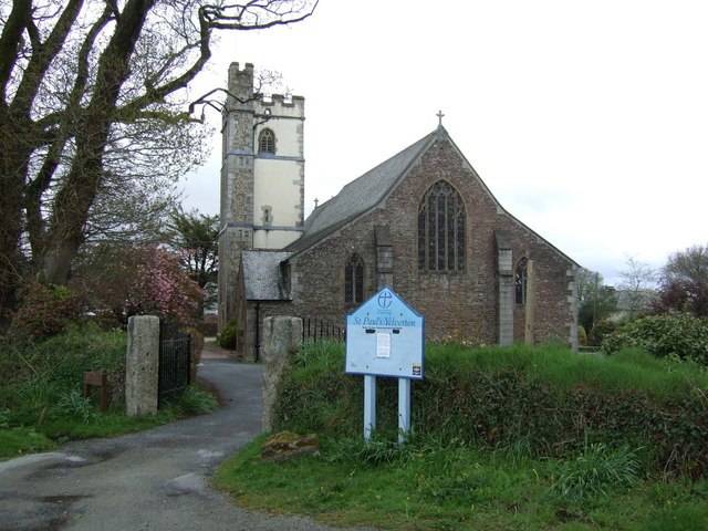
Photo: JThomas, CC BY-SA 2.0.
Yelverton is a large village on the south-western edge of Dartmoor, Devon, in England. It is in the civil parish of Buckland Monachorum. According to the 2021 census, it had a population of 1,858, which was slightly more than the 1,810 recorded at the 2011 census.
Lower Leather Tor
- Type: Peak with an elevation of 1,148 feet
- Category: landform
- Location: Walkhampton, West Devon District, Devon, West Country, England, United Kingdom, Britain and Ireland, Europe
- View on OpenStreetMap
Latitude
50.5102° or 50° 30′ 37″ northLongitude
-4.0283° or 4° 1′ 42″ westElevation
1,148 feet (350 metres)Open location code
9C2QGX6C+3MOpenStreetMap ID
node 11341114620OpenStreetMap feature
natural=peak
This page is based on OpenStreetMap, Wikidata, and Wikimedia Commons.
We’d love your help improving our open data sources. Thank you for contributing.
Satellite Map
Discover Lower Leather Tor from above in high-definition satellite imagery.
Localities in the Area
Explore places such as Leather Tor Farm and Vinneylake (ruins).
Notable Places Nearby
Highlights include Leather Tor and Cist.
Devon: Must-Visit Destinations
Delve into Plymouth, Exeter, Torquay, and Barnstaple.
Curious Peaks to Discover
Uncover intriguing peaks from every corner of the globe.
About Mapcarta. Data © OpenStreetMap contributors and available under the Open Database License". Text is available under the CC BY-SA 4.0 license, except for photos, directions, and the map. Photo: matthewhartley369, CC BY-SA 2.0.