Centre de Santé et de Services Sociaux de Laval
Centre de Santé et de Services Sociaux de Laval is a government office in Laval, Southwestern Quebec, Quebec. Centre de Santé et de Services Sociaux de Laval is situated nearby to the health club 30 Minute Hit, as well as near the park Halte de Livourne.| Tap on a place to explore it |
Places of Interest Nearby
Highlights include Vimont station and Sainte-Rose station.
Vimont station
Railway station

Photo: Mtlfiredude, CC BY-SA 3.0.
Vimont station is a commuter rail station operated by Exo in Laval, Quebec, Canada. It is served by the Saint-Jérôme line. The station is in ARTM fare zone B, and currently has 200 parking spaces. Vimont station is situated 2 km west of Centre de Santé et de Services Sociaux de Laval.
Sainte-Rose station
Railway station

Photo: Ed7789, CC BY-SA 4.0.
Sainte-Rose station is a commuter rail station operated by Exo in Laval, Quebec, Canada. It is served by the Saint-Jérôme line. The station is located in ARTM fare zone B, and currently has 713 parking spaces and a bus loop. Sainte-Rose station is situated 4 km northwest of Centre de Santé et de Services Sociaux de Laval.
Places in the Area
Nearby places include Sault-au-Récollet and Rosemère.
Sault-au-Récollet
Neighborhood
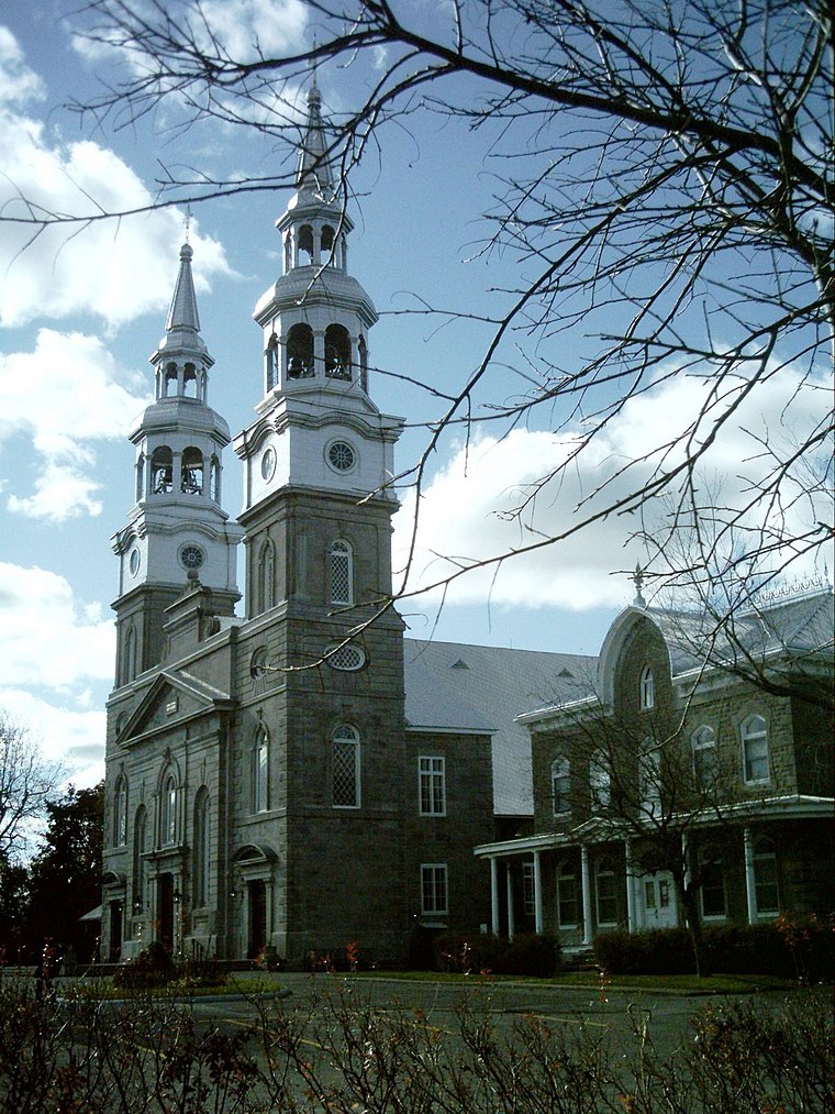
Photo: Wikimedia, CC BY-SA 3.0.
Sault-au-Récollet is a neighbourhood in Montreal. It is located in the eastern edge of the borough of Ahuntsic-Cartierville, bordering the Rivière des Prairies. Sault-au-Récollet is situated 6 km southeast of Centre de Santé et de Services Sociaux de Laval.
Rosemère
Town

Photo: Yuicopr, CC BY-SA 3.0.
Rosemère is an affluent suburb of Montreal, in southwestern Quebec, Canada on the north shore of the Rivière des Mille Îles in the Thérèse-De Blainville Regional County Municipality. Rosemère is situated 7 km west of Centre de Santé et de Services Sociaux de Laval.
Lorraine
Town

Photo: Rikipi, CC BY-SA 3.0.
Lorraine is an affluent off-island suburb of Montreal, in southwestern Quebec, Canada on the north shore of the Rivière des Mille-Îles in the Thérèse-De Blainville Regional County Municipality. Lorraine is situated 9 km northwest of Centre de Santé et de Services Sociaux de Laval.
Centre de Santé et de Services Sociaux de Laval
- Type: Government office
- Categories: office and government building
- Location: Laval, Southwestern Quebec, Quebec, Canada, North America
- View on OpenStreetMap
Latitude
45.60864° or 45° 36′ 31″ northLongitude
-73.72011° or 73° 43′ 12″ westOpen location code
87Q8J75H+FXOpenStreetMap ID
node 11346265614OpenStreetMap feature
office=government
This page is based on OpenStreetMap, Wikidata, and Wikimedia Commons.
We’d love your help improving our open data sources. Thank you for contributing.
Satellite Map
Discover Centre de Santé et de Services Sociaux de Laval from above in high-definition satellite imagery.
Notable Places Nearby
Highlights include 30 Minute Hit and Halte de Livourne.
Nearby Places
Explore places such as Dolce Sapore and Gualdieri.
Southwestern Quebec: Must-Visit Destinations
Delve into Montreal, Sherbrooke, Longueuil, and Montreal-Pierre Elliott Trudeau International Airport.
Curious Government Offices to Discover
Uncover intriguing government offices from every corner of the globe.
About Mapcarta. Data © OpenStreetMap contributors and available under the Open Database License". Text is available under the CC BY-SA 4.0 license, except for photos, directions, and the map. Photo: Inkey, CC BY 2.0.