Peu du Montet
Peu du Montet is a peak in Ajain, Arrondissement of Guéret, Nouvelle-Aquitaine and has an elevation of 504 metres. Peu du Montet is situated nearby to the hamlet Puy Gaillard, as well as near the locality Le Grand Verger.| Tap on a place to explore it |
Places of Interest
Highlights include Église de l’Assomption-de-la-Vierge d’Ajain and Château de la Dauge.
Église de l’Assomption-de-la-Vierge d’Ajain
Church
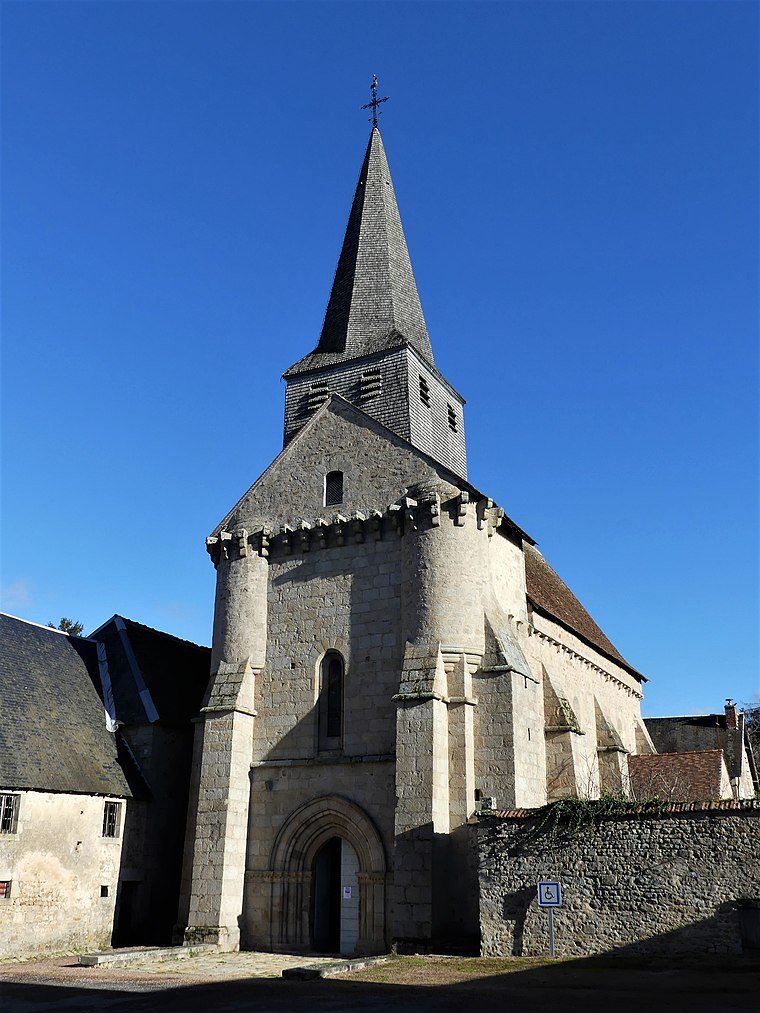
Photo: Père Igor, CC BY-SA 4.0.
Église de l’Assomption-de-la-Vierge d’Ajain is a church.
Église Saint-Sulpice de Ladapeyre
Church

Photo: Père Igor, CC BY-SA 4.0.
Église Saint-Sulpice de Ladapeyre is a church.
Places in the Area
Nearby places include Ajain and Ladapeyre.
Ajain
Village

Photo: Père Igor, CC BY-SA 4.0.
Ajain is a commune in the Creuse department in the Nouvelle-Aquitaine region in central France.
Ladapeyre
Village

Photo: Aubussonais, CC BY-SA 4.0.
Ladapeyre is a commune in the Creuse department in the Nouvelle-Aquitaine region in central France.
Jarnages
Village

Photo: Père Igor, CC BY-SA 4.0.
Jarnages is a commune in the Creuse department in the Nouvelle-Aquitaine region in France.
Peu du Montet
- Type: Peak with an elevation of 504 metres
- Category: landform
- Location: Ajain, Arrondissement of Guéret, Creuse, Nouvelle-Aquitaine, France, Europe
- View on OpenStreetMap
Latitude
46.224° or 46° 13′ 26″ northLongitude
2.0234° or 2° 1′ 24″ eastElevation
504 metres (1,654 feet)Open location code
8FR462FF+H9OpenStreetMap ID
node 11359898707OpenStreetMap feature
natural=peak
This page is based on OpenStreetMap, Wikidata, and Wikimedia Commons.
We’d love your help improving our open data sources. Thank you for contributing.
Satellite Map
Discover Peu du Montet from above in high-definition satellite imagery.
Localities in the Area
Explore places such as Puy Gaillard and Le Grand Verger.
Notable Places Nearby
Highlights include Carrière and Manège.
Nouvelle-Aquitaine: Must-Visit Destinations
Delve into Bordeaux, Deux-Sèvres, Charente, and Poitiers.
Curious Peaks to Discover
Uncover intriguing peaks from every corner of the globe.
About Mapcarta. Data © OpenStreetMap contributors and available under the Open Database License". Text is available under the CC BY-SA 4.0 license, except for photos, directions, and the map. Photo: Noeljupiter, CC BY-SA 3.0.