Holgate Park
Holgate Park is a bus stop in York, England. Holgate Park is situated nearby to Holgate Windmill, as well as near Holgate Methodist Church.| Tap on a place to explore it |
Places of Interest Nearby
Highlights include Holgate Windmill and York Cold War Bunker.
Holgate Windmill

Photo: Synaptic peach, CC BY-SA 3.0.
Holgate Windmill is a tower mill at Holgate in York, North Yorkshire, England which has been restored to working order. Holgate Windmill is situated 660 feet southwest of Holgate Park.
York Cold War Bunker

Photo: Mike Peel, CC BY-SA 4.0.
The York Cold War Bunker is a two-storey, semi-subterranean, Cold War bunker in the Holgate area of York, England, built in 1961 to monitor nuclear explosions and fallout in Yorkshire, in the event of nuclear war. York Cold War Bunker is situated 1,700 feet west of Holgate Park.
York Minster
Church
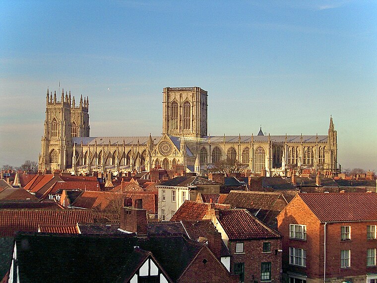
Photo: MatzeTrier, CC BY-SA 3.0.
York Minster, formally the Cathedral and Metropolitical Church of Saint Peter in York, is an Anglican cathedral in the city of York, North Yorkshire, England. York Minster is situated 1¼ miles east of Holgate Park.
Places in the Area
Nearby places include Holgate and Acomb.
Holgate
Suburb
Holgate is a suburb of York in the ceremonial county of North Yorkshire, England. It is located about 1 mile west of Micklegate Bar in the city walls. Holgate is also the name of an electoral ward in the City of York unitary authority.
Acomb
Suburb

Photo: Wikimedia, CC BY-SA 2.0.
Acomb, is a village and suburb within the City of York unitary authority area, in North Yorkshire, England, to the western side of York. It covers the site of the original village of the same name, which is mentioned in the Domesday Book of 1086.
Bishophill
Suburb
Bishophill is an area of central York, in England. It lies within the city walls and has been occupied since at least the Roman period.
Holgate Park
- Type: Bus stop
- Category: transportation
- Location: York, England, United Kingdom, Britain and Ireland, Europe
- View on OpenStreetMap
Latitude
53.95716° or 53° 57′ 26″ northLongitude
-1.10872° or 1° 6′ 31″ westOpen location code
9C5WXV4R+VGOpenStreetMap ID
node 1137432635OpenStreetMap feature
highway=bus_stopOpenStreetMap feature
public_transport=platform
This page is based on OpenStreetMap, Wikidata, and Wikimedia Commons.
We’d love your help improving our open data sources. Thank you for contributing.
Satellite Map
Discover Holgate Park from above in high-definition satellite imagery.
Notable Places Nearby
Highlights include Holgate Methodist Church and The Fox.
Nearby Places
Explore places such as Pattinson Brewer and Poppleton Road South.
England: Must-Visit Destinations
Delve into London, Manchester, Sheffield, and Leeds.
Curious Bus Stops to Discover
Uncover intriguing bus stops from every corner of the globe.
About Mapcarta. Data © OpenStreetMap contributors and available under the Open Database License". Text is available under the CC BY-SA 4.0 license, except for photos, directions, and the map. Photo: sidibousaid, CC BY 2.0.