Programme d’évaluation des conducteurs automobiles
Programme d’évaluation des conducteurs automobiles is a government office in Quebec, Canada which is located on Rue de Louvain Est. Programme d’évaluation des conducteurs automobiles is situated nearby to the government office Travaux Publics Ville de Montréal, as well as near Division de l’expertise et du soutien technique - Direction de la réalisation des travaux.| Tap on a place to explore it |
Places of Interest Nearby
Highlights include Sauvé station and Complexe sportif Claude-Robillard.
Sauvé station
Railway station
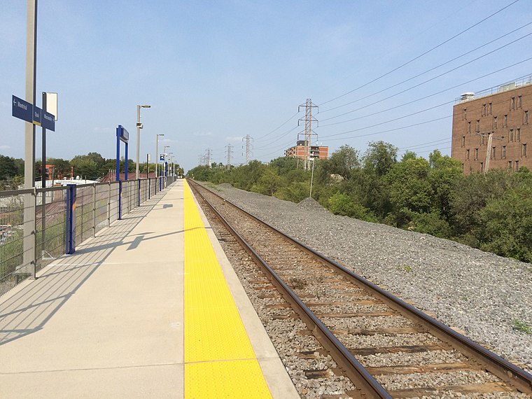
Photo: Mtlfiredude, CC BY-SA 3.0.
Sauvé station is an intermodal transit station in the borough of Ahuntsic-Cartierville in Montreal, Quebec, Canada. The Montreal Metro station is operated by the Société de transport de Montréal and serves the Orange Line. Sauvé station is situated 750 metres southwest of Programme d’évaluation des conducteurs automobiles.
Complexe sportif Claude-Robillard
Sports venue
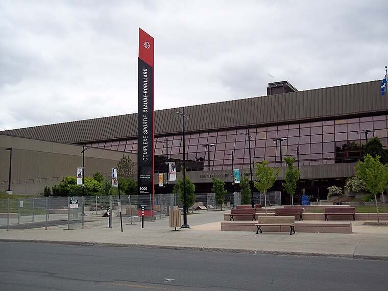
Photo: Wikimedia, CC BY-SA 3.0.
The Complexe sportif Claude-Robillard, abbreviated CSCR and often referred as Centre Claude-Robillard, is a multi-purpose sport facility, located in Montreal, Quebec, Canada, in the borough of Ahuntsic-Cartierville. Complexe sportif Claude-Robillard is situated 1 km east of Programme d’évaluation des conducteurs automobiles.

Places in the Area
Nearby places include Montreal and Sault-au-Récollet.
Montreal

Photo: Wikimedia, CC BY-SA 3.0.
Montreal is the largest city in the Canadian province of Quebec. While Quebec City is the political capital, Montreal is the cultural and economic centre, and the main entry point to the province.
Sault-au-Récollet
Neighborhood
Photo: Wikimedia, CC BY-SA 3.0.
Sault-au-Récollet is a neighbourhood in Montreal. It is located in the eastern edge of the borough of Ahuntsic-Cartierville, bordering the Rivière des Prairies.
Mount Royal
Town

Photo: Stanisom, CC BY-SA 3.0.
Mount Royal is an affluent on-island suburban town located on the northwest side of the eponymous Mount Royal, northwest of Downtown Montreal, on the Island of Montreal in southwestern Quebec, Canada. Mount Royal is situated 4½ km south of Programme d’évaluation des conducteurs automobiles.
Programme d’évaluation des conducteurs automobiles
- Type: Government office
- Address: 970 Rue de Louvain Est, Montréal, QC
- Categories: office and government building
- Location: Quebec, Canada, North America
- View on OpenStreetMap
Latitude
45.55451° or 45° 33′ 16″ northLongitude
-73.64809° or 73° 38′ 53″ westOperator
Société d’assurance automobile du QuébecOpen location code
87Q8H932+RQOpenStreetMap ID
node 11386058332OpenStreetMap feature
office=government
This page is based on OpenStreetMap, Wikidata, and Wikimedia Commons.
We’d love your help improving our open data sources. Thank you for contributing.
Satellite Map
Discover Programme d’évaluation des conducteurs automobiles from above in high-definition satellite imagery.
Notable Places Nearby
Highlights include Travaux Publics Ville de Montréal and Division de l’expertise et du soutien technique - Direction de la réalisation des travaux.
Nearby Places
Explore places such as Centre de réadaptation en dépendance de Montréal and Saint-Hubert / de Louvain.
Quebec: Must-Visit Destinations
Delve into Montreal, Gaspé, Quebec City, and Percé.
Curious Government Offices to Discover
Uncover intriguing government offices from every corner of the globe.
About Mapcarta. Data © OpenStreetMap contributors and available under the Open Database License". Text is available under the CC BY-SA 4.0 license, except for photos, directions, and the map. Photo: Taxiarchos228, CC BY-SA 3.0.