Antithesis Clothing
Antithesis Clothing is a clothing store in Delta, Thessaloniki, Central Macedonia which is located on Νικολάου Πλαστήρα. Antithesis Clothing is situated nearby to the square Τσακιρίδη, as well as near the government office ΚΕΠ ΚΑΛΛΙΘΕΑΣ.| Tap on a place to explore it |
Places of Interest Nearby
Highlights include Church of Saint Demetrios.
Church of Saint Demetrios
Church

Photo: Extratall, CC BY-SA 4.0.
Church of Saint Demetrios is situated 390 metres southeast of Antithesis Clothing.
Places in the Area
Nearby places include Araplí and Neochorouda.
Araplí
Town
Nea Magnisia, before 1927 known as Arapli, is a town and a community of the Delta municipality. Before the 2011 local government reform it was part of the municipality of Echedoros, of which it was a municipal district.
Neochorouda
Town
Neochorouda is a village in the Oraiokastro municipality, Thessaloniki regional unit, northern Greece. It was formerly known as Tria Hania. The village itself was built on the crossroads of the road between Kilkis and Athens and thus saw a lot of traffic, hence the name. Neochorouda is situated 6 km north of Antithesis Clothing.
Evosmos
Suburb
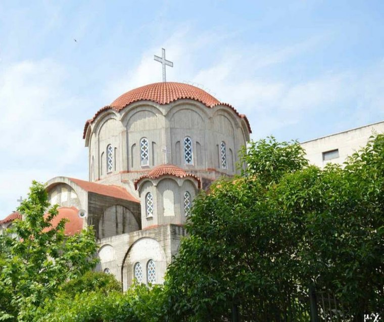
Photo: Jerotheo, CC BY-SA 4.0.
Evosmos is a suburb of the Thessaloniki Urban Area and was a former municipality in the regional unit of Thessaloniki, Macedonia, Greece. Since the 2011 local government reform it is part of the municipality Kordelio-Evosmos, of which it is the seat and a municipal unit. Evosmos is situated 6 km east of Antithesis Clothing.
Antithesis Clothing
- Type: Clothing store
- Address: Νικολάου Πλαστήρα 2, Θεσσαλονίκη, 57008
- Category: shop
- Location: Delta, Thessaloniki, Central Macedonia, Greece, Balkans, Europe
- View on OpenStreetMap
Latitude
40.68997° or 40° 41′ 24″ northLongitude
22.85504° or 22° 51′ 18″ eastOpen location code
8GG4MVQ4+X2OpenStreetMap ID
node 11393637345OpenStreetMap feature
shop=fashion_accessories
This page is based on OpenStreetMap, Wikidata, and Wikimedia Commons.
We’d love your help improving our open data sources. Thank you for contributing.
Satellite Map
Discover Antithesis Clothing from above in high-definition satellite imagery.
Notable Places Nearby
Highlights include Τσακιρίδη and ΚΕΠ ΚΑΛΛΙΘΕΑΣ.
Nearby Places
Explore places such as ΔΥΠΑ ΚΠΑ2 Ιωνίας Θεσσαλονίκης and ΕΘΝΙΚΗΣ ΑΝΤΙΣΤΑΣΗΣ.
Greece: Must-Visit Destinations
Delve into Athens, Thessaloniki, Lesvos, and Arcadia.
Curious Clothing Stores to Discover
Uncover intriguing clothing stores from every corner of the globe.
About Mapcarta. Data © OpenStreetMap contributors and available under the Open Database License". Text is available under the CC BY-SA 4.0 license, except for photos, directions, and the map. Photo: Wikimedia, CC0.