The PRIDE Academy
The PRIDE Academy is a school in Hillingdon, Greater London, England which is located on Falling Lane. The PRIDE Academy is situated nearby to the school The Skills Hub, as well as near Rabbsfarm Primary School.| Tap on a place to explore it |
Places of Interest Nearby
Highlights include West Drayton railway station and St Matthew’s.
West Drayton railway station
Railway station
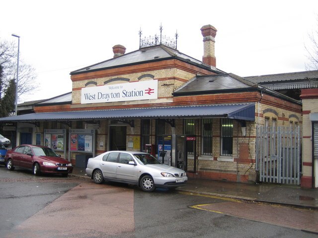
Photo: Nigel Cox, CC BY-SA 2.0.
West Drayton railway station serves West Drayton and Yiewsley, western suburbs of London. It is served and managed by the Elizabeth line. It is 13 miles 71 chains down the line from London Paddington and is situated between Hayes & Harlington to the east and Iver to the west. West Drayton railway station is situated 3,100 feet south of The PRIDE Academy.
St Matthew’s
Church

Photo: Jones44444, CC BY-SA 4.0.
St Matthew’s is a church, which is situated 1,900 feet south of The PRIDE Academy.
Hillingdon Hospital
Hospital

Photo: Marion Phillips, CC BY-SA 2.0.
Hillingdon Hospital is a hospital in Hillingdon, London. It is one of two hospitals run by The Hillingdon Hospitals NHS Foundation Trust, the other being Mount Vernon Hospital. Hillingdon Hospital is situated 3,600 feet northeast of The PRIDE Academy.
Places in the Area
Nearby places include Yiewsley and Cowley.
Yiewsley
Suburb

Photo: John Goodall, CC BY-SA 2.0.
Yiewsley is a large suburban village in the London Borough of Hillingdon, England, 2 miles south of Uxbridge, the borough's commercial and administrative centre.
Cowley
Suburb

Photo: Nigel Cox, CC BY-SA 2.0.
Cowley is a village contiguous with the town of Uxbridge in the London Borough of Hillingdon. A largely suburban village with 16 listed buildings, Cowley is 15.4 miles west of Charing Cross, bordered to the west by Uxbridge Moor in the Green Belt and the River Colne, forming the border with Buckinghamshire.
West Drayton
Suburb

Photo: Rod Allday, CC BY-SA 2.0.
West Drayton is a suburban town in the London Borough of Hillingdon. It was an ancient parish in the county of Middlesex and from 1929 was part of the Yiewsley and West Drayton Urban District, which became part of Greater London in 1965.
The PRIDE Academy
- Type: School
- Address: Falling Lane, Yiewsley, West Drayton, UB7 8AB
- Category: education
- Location: Hillingdon, Greater London, England, United Kingdom, Britain and Ireland, Europe
- View on OpenStreetMap
Latitude
51.51813° or 51° 31′ 5″ northLongitude
-0.47164° or 0° 28′ 18″ westOpen location code
9C3XGG9H+78OpenStreetMap ID
node 11403337361OpenStreetMap feature
amenity=school
This page is based on OpenStreetMap, Wikidata, and Wikimedia Commons.
We’d love your help improving our open data sources. Thank you for contributing.
Satellite Map
Discover The PRIDE Academy from above in high-definition satellite imagery.
Notable Places Nearby
Highlights include The Skills Hub and Rabbsfarm Primary School.
Nearby Places
Explore places such as Otterfield Road and Milburn Drive.
England: Must-Visit Destinations
Delve into London, Manchester, Sheffield, and Leeds.
Curious Places to Discover
Uncover intriguing places from every corner of the globe.
About Mapcarta. Data © OpenStreetMap contributors and available under the Open Database License". Text is available under the CC BY-SA 4.0 license, except for photos, directions, and the map. Photo: sidibousaid, CC BY 2.0.