kath. Kirche St. Antonius
kath. Kirche St. Antonius is a church in Ransbach-Baumbach, Westerwaldkreis, Rhineland-Palatinate. kath. Kirche St. Antonius is situated nearby to the community center Stadthalle Ransbach-Baumbach, as well as near the hackspace Westwoodlabs e.V..| Tap on a place to explore it |
Places of Interest Nearby
Highlights include St. Markus and Felsengruppe Bühl.
St. Markus
Church
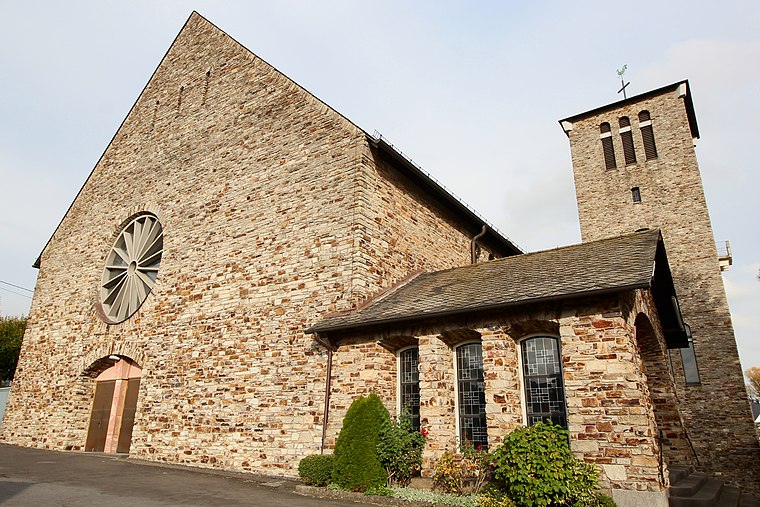
Photo: LigaDue, CC BY-SA 4.0.
St. Markus is a church, which is situated 1½ km northeast of kath. Kirche St. Antonius.
Felsengruppe Bühl
Protected area

Photo: LigaDue, CC BY-SA 4.0.
Felsengruppe Bühl is a protected area, which is situated 2 km west of kath. Kirche St. Antonius.
Köppel
Peak

Photo: Wikimedia, CC BY-SA 3.0.
The Köppel, at 540.2 m above sea level, is the second highest point in the Montabaur Heights, an elongated hill ridge in the Lower Westerwald in Germany. Köppel is situated 3½ km southeast of kath. Kirche St. Antonius.
Places in the Area
Nearby places include Hundsdorf and Hilgert.
Hundsdorf
Village

Photo: Wolkenkratzer, CC BY-SA 4.0.
Hundsdorf is an Ortsgemeinde – a community belonging to a Verbandsgemeinde – in the Westerwaldkreis in Rhineland-Palatinate, Germany.
Hilgert
Village

Photo: LigaDue, CC BY-SA 4.0.
Hilgert in the Kannenbäckerland is an Ortsgemeinde – a community belonging to a Verbandsgemeinde – in the Westerwaldkreis in Rhineland-Palatinate, Germany.
Kammerforst
Village

Photo: LigaDue, CC BY-SA 4.0.
Kammerforst in the Kannenbäckerland is an Ortsgemeinde – a community belonging to a Verbandsgemeinde – in the Westerwaldkreis in Rhineland-Palatinate, Germany. Kammerforst is situated 3½ km west of kath. Kirche St. Antonius.
kath. Kirche St. Antonius
- Type: Church
- Wheelchair access: yes
- Categories: place of worship and religion
- Location: Ransbach-Baumbach, Westerwaldkreis, Rhineland-Palatinate, Germany, Central Europe, Europe
- View on OpenStreetMap
Latitude
50.45684° or 50° 27′ 25″ northLongitude
7.72245° or 7° 43′ 21″ eastOpen location code
9F29FP4C+PXOpenStreetMap ID
node 11419960948OpenStreetMap feature
amenity=place_of_worshipOpenStreetMap attribute
wheelchair=yes
This page is based on OpenStreetMap, Wikidata, and Wikimedia Commons.
We’d love your help improving our open data sources. Thank you for contributing.
Satellite Map
Discover kath. Kirche St. Antonius from above in high-definition satellite imagery.
Places with the Same Name
Discover other places named “kath. Kirche St. Antonius”.
Notable Places Nearby
Highlights include Stadthalle Ransbach-Baumbach and Westwoodlabs e.V..
Nearby Places
Explore places such as Pfarramt and Meurer.
Rhineland-Palatinate: Must-Visit Destinations
Delve into Mainz, Trier, Koblenz, and Worms.
Curious Churches to Discover
Uncover intriguing churches from every corner of the globe.
About Mapcarta. Data © OpenStreetMap contributors and available under the Open Database License". Text is available under the CC BY-SA 4.0 license, except for photos, directions, and the map. Photo: Traveler100, CC BY-SA 3.0.