Familie Nagiel-Amtmann
Familie Nagiel-Amtmann is a memorial in Belgium. Familie Nagiel-Amtmann is situated nearby to the arts center Gallait 80 / Plan Atelier, as well as near the community center Gemeenschapscentrum De Kriekelaar.| Tap on a place to explore it |
Places of Interest Nearby
Highlights include Church of St. Francis of Assisi and Brussels-North Railway Station.
Church of St. Francis of Assisi
Church

Photo: Lumixbx, CC BY-SA 3.0.
Church of St. Francis of Assisi is situated 170 metres west of Familie Nagiel-Amtmann.
Brussels-North Railway Station
Railway station
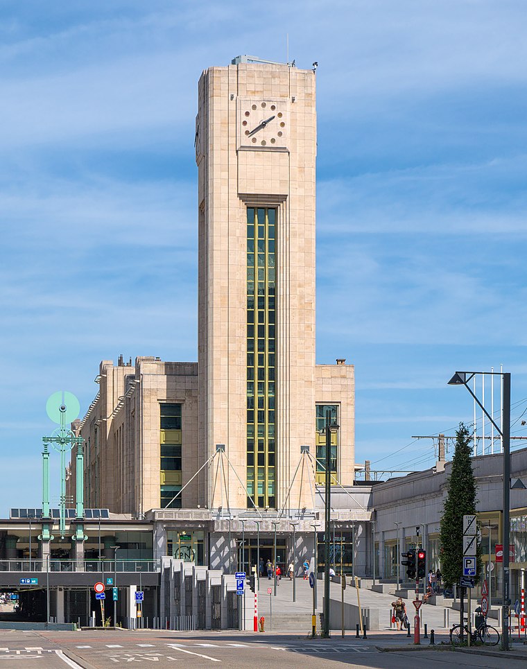 Brussels-North railway station is one of the three major railway stations in Brussels, Belgium; the other two are Brussels-Central and Brussels-South. Every regular domestic and international train passing there has a planned stop. Brussels-North Railway Station is situated 1 km southwest of Familie Nagiel-Amtmann.
Schaerbeek Municipal Hall
Town hall

Photo: M0tty, CC BY-SA 3.0.
The Municipal Hall of Schaerbeek is the municipal hall building and the seat of that municipality of Brussels, Belgium. Designed by the architect Jules Jacques Van Ysendyck in neo-Flemish Renaissance style and completed in 1887, it is located at the centre of the Place Colignon/Colignonplein. Schaerbeek Municipal Hall is situated 360 metres east of Familie Nagiel-Amtmann.
Places in the Area
Nearby places include Schaarbeek and Bear Pit.
Schaarbeek

Photo: Varech, CC BY-SA 3.0.
Schaerbeek or Schaarbeek is one of the 19 municipalities of the Brussels-Capital Region, Belgium. Located in the north-eastern part of the region, it is bordered by the City of Brussels, Etterbeek, Evere and Saint-Josse-ten-Noode.


Familie Nagiel-Amtmann
- Type: Memorial
- Category: historic site
- Location: Belgium, Benelux, Europe
- View on OpenStreetMap
Latitude
50.8667° or 50° 52′ 0″ northLongitude
4.36872° or 4° 22′ 7″ eastOpen location code
9F26V989+MFOpenStreetMap ID
node 11432800451OpenStreetMap feature
historic=memorial
This page is based on OpenStreetMap, Wikidata, and Wikimedia Commons.
We’d love your help improving our open data sources. Thank you for contributing.
Satellite Map
Discover Familie Nagiel-Amtmann from above in high-definition satellite imagery.
Notable Places Nearby
Highlights include Gallait 80 / Plan Atelier and Gemeenschapscentrum De Kriekelaar.
Nearby Places
Explore places such as Gallait and Campus Kompas.
Belgium: Must-Visit Destinations
Delve into Brussels, Antwerp, Ghent, and Liège.
Curious Memorials to Discover
Uncover intriguing memorials from every corner of the globe.
About Mapcarta. Data © OpenStreetMap contributors and available under the Open Database License". Text is available under the CC BY-SA 4.0 license, except for photos, directions, and the map. Photo: Gf uip, CC BY-SA 3.0.