Fehmarn Tafel
Fehmarn Tafel is a social service facility in Fehmarn, Ostholstein, Schleswig-Holstein. Fehmarn Tafel is situated nearby to the church St.-Jürgen-Kapelle, as well as near the fire station Freiwillige Feuerwehr Burg.| Tap on a place to explore it |
Places of Interest Nearby
Highlights include St.-Jürgen-Kapelle and Rathaus Burg auf Fehmarn.
St.-Jürgen-Kapelle
Church

Photo: Torbenbrinker, CC BY-SA 3.0.
St.-Jürgen-Kapelle is a church, which is situated 400 metres southwest of Fehmarn Tafel.
Rathaus Burg auf Fehmarn
Town hall
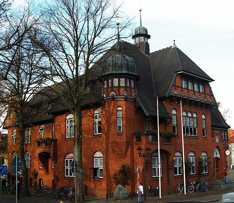
Photo: S.moeller, Public domain.
Rathaus Burg auf Fehmarn is a town hall, which is situated 1 km northwest of Fehmarn Tafel.
St. Nicholas Church, Fehmarn
Church

Photo: Beckstet, CC BY-SA 3.0.
St. Nicholas Church is a church in the city of Burg on the German Baltic island of Fehmarn. St. Nicholas Church, Fehmarn is situated 780 metres west of Fehmarn Tafel.
Places in the Area
Nearby places include Burg auf Fehmarn and Burgstaaken.


Landkirchen auf Fehmarn
Village

Photo: Torbenbrinker, CC BY-SA 3.0.
Landkirchen auf Fehmarn is a village, which is situated 4 km northwest of Fehmarn Tafel.
Fehmarn Tafel
- Opening hours: Tuesday 9:30 AM—2:30 PM
- Type: Social service facility
- Location: Fehmarn, Ostholstein, East Holstein, Schleswig-Holstein, Germany, Central Europe, Europe
- View on OpenStreetMap
Latitude
54.43469° or 54° 26′ 5″ northLongitude
11.20809° or 11° 12′ 29″ eastOperator
Ev.-Luth. Kirchen auf FehmarnOpen location code
9F6HC6M5+V6OpenStreetMap ID
node 11438937107OpenStreetMap feature
amenity=social_facility
This page is based on OpenStreetMap, Wikidata, and Wikimedia Commons.
We’d love your help improving our open data sources. Thank you for contributing.
Satellite Map
Discover Fehmarn Tafel from above in high-definition satellite imagery.
Notable Places Nearby
Highlights include Freiwillige Feuerwehr Burg and Boy with foal.
Nearby Places
Explore places such as Hotel Hasselbarth and St. Jürgen Kapelle.
East Holstein: Must-Visit Destinations
Delve into Lübeck, Ratzeburg, Timmendorfer Strand, and Grömitz.
Curious Social Service Facilities to Discover
Uncover intriguing social service facilities from every corner of the globe.
About Mapcarta. Data © OpenStreetMap contributors and available under the Open Database License". Text is available under the CC BY-SA 4.0 license, except for photos, directions, and the map. Photo: Wikimedia, Public domain.