Milecastle 46
Milecastle 46 was a milecastle on Hadrian's Wall.| Tap on a place to explore it |
Photo: Mike Quinn, CC BY-SA 2.0.
- Type: Archaeological site
- Description: milecastle on Hadrian’s Wall
- Also known as: “Carvoran (milecastle)”, “MC46”, and “Milecastle 36 (Carvoran)”
Places of Interest Nearby
Highlights include Magnis and Thirlwall Castle.
Magnis
Archaeological site

Photo: Mike Quinn, CC BY-SA 2.0.
Magnis or Magna was a Roman fort near Hadrian's Wall in northern Britain. Its ruins are now known as Carvoran Roman Fort and are located near Carvoran, Northumberland, in northern England. Magnis is situated 1,100 feet south of Milecastle 46.
Thirlwall Castle
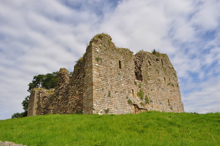
Photo: Ashley Dace, CC BY-SA 2.0.
Thirlwall Castle is a 12th-century castle in Northumberland, England, on the bank of the River Tipalt close to the village of Greenhead and approximately 20 miles west of Hexham. Thirlwall Castle is situated 1,800 feet west of Milecastle 46.
Church of St Cuthbert
Church

Photo: Bill Henderson, CC BY-SA 2.0.
Church of St Cuthbert is situated 2,700 feet southwest of Milecastle 46.
Places in the Area
Nearby places include Gilsland and Haltwhistle.
Gilsland
Village

Photo: Mike Quinn, CC BY-SA 2.0.
Gilsland is a village in northern England about 20 miles west of Hexham, and about 18 miles east of Carlisle, which straddles the border between Cumbria and Northumberland. Gilsland is situated 2 miles west of Milecastle 46.
Haltwhistle

Photo: Tony Hisgett, CC BY 2.0.
Haltwhistle is a market town in Northumberland, along the route between Newcastle and Carlisle, with a population of 4650 in 2021. It contrived to be named for a railway halt over 600 years before that railway arrived: Hautwysel means a hill between two forks of a river. Hadrian's Wall is the main reason to visit, the Roman frontier defence built in 122 AD.
Rowfoot
Hamlet
Rowfoot is a hamlet in the civil parish of Featherstone, in Northumberland, England. It was historically served by Featherstone Park railway station. Rowfoot is situated 3½ miles south of Milecastle 46.
Milecastle 46
- Categories: milecastle, historic site, tourist attraction, and tourism
- Location: Thirlwall, Northumberland, North East England, England, United Kingdom, Britain and Ireland, Europe
- View on OpenStreetMap
Latitude
54.98764° or 54° 59′ 16″ northLongitude
-2.52558° or 2° 31′ 32″ westOpen location code
9C6VXFQF+3QOpenStreetMap ID
node 11450110015OpenStreetMap feature
historic=archaeological_siteWikidata ID
Q16156605
This page is based on OpenStreetMap, Wikidata, Wikimedia Commons, and Wikipedia.
We’d love your help improving our open data sources. Thank you for contributing.
Satellite Map
Discover Milecastle 46 from above in high-definition satellite imagery.
In Other Languages
“Milecastle 46” goes by many names.
- German: “Meilenkastell 46”
- German: “Meilenkastell Carvoran”
- German: “MK 46”
Notable Places Nearby
Highlights include Roman Army Museum and Walltown Quarry.
Nearby Places
Explore places such as Roman Army Museum and Walltown Quarry.
Northumberland: Must-Visit Destinations
Delve into Berwick-upon-Tweed, Lindisfarne, Alnwick, and Morpeth.
Curious Archaeological Sites to Discover
Uncover intriguing archaeological sites from every corner of the globe.
About Mapcarta. Data © OpenStreetMap contributors and available under the Open Database License". Text is available under the CC BY-SA 4.0 license, except for photos, directions, and the map. Description text is based on the Wikipedia page “Milecastle 46”. Photo: Mike Quinn, CC BY-SA 2.0.