Wills Bunk Barn
Wills Bunk Barn is a guest house in Butterton, Staffordshire Moorlands, England. Wills Bunk Barn is situated nearby to the village Butterton, as well as near the peak Ossoms Hill.| Tap on a place to explore it |
Places of Interest Nearby
Highlights include St Bartholomew’s Church, Butterton and Church of All Saints.
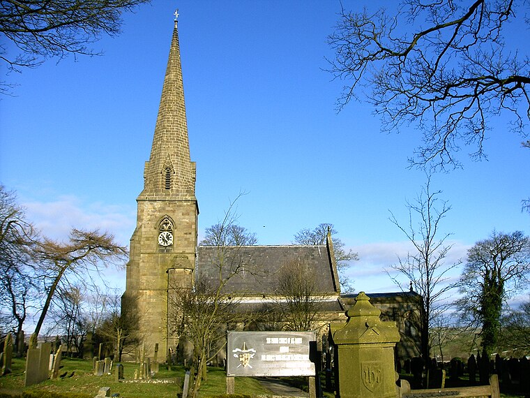
St Bartholomew’s Church, Butterton
Church

Photo: Brian Deegan, CC BY-SA 2.0.
St Bartholomew's Church, Butterton is a Grade II listed parish church in the Church of England in Butterton. St Bartholomew’s Church, Butterton is situated 2,400 feet west of Wills Bunk Barn.
Swainsley Tunnel
Tunnel

Photo: RailwayJG, CC BY-SA 4.0.
Swainsley Tunnel is a tunnel on the route of the former Leek and Manifold Light Railway, which connected the market town of Leek with Hulme End, via Waterhouses, in Staffordshire, England. Swainsley Tunnel is situated 1 mile northeast of Wills Bunk Barn.
Places in the Area
Nearby places include Butterton and Grindon.
Butterton
Village

Photo: Geoff Pick, CC BY-SA 2.0.
Butterton is a small village in the Staffordshire Moorlands in Staffordshire, England. It is close to the Peak District. It overlooks the Manifold Valley and Ecton Hill, which rises 1,212 feet above sea level.
Grindon
Village
 Grindon is a small village in the Staffordshire Moorlands district of Staffordshire, England. Close to the Peak District.
Warslow
Village

Photo: Row17, CC BY-SA 2.0.
Warslow is a small village in the Staffordshire Moorlands of Staffordshire, England. It is located in the Peak District National Park about 10 miles north of Ashbourne. The village lies close to the Derbyshire border.
Wills Bunk Barn
- Type: Guest house
- Postal code: ST13 7ST
- Categories: tourism, accommodation, and building
- Location: Butterton, Staffordshire Moorlands, Staffordshire, West Midlands, England, United Kingdom, Britain and Ireland, Europe
- View on OpenStreetMap
Latitude
53.10459° or 53° 6′ 17″ northLongitude
-1.87768° or 1° 52′ 40″ westOpen location code
9C5W443C+RWOpenStreetMap ID
node 11482907908OpenStreetMap feature
tourism=guest_house
This page is based on OpenStreetMap, Wikidata, and Wikimedia Commons.
We’d love your help improving our open data sources. Thank you for contributing.
Satellite Map
Discover Wills Bunk Barn from above in high-definition satellite imagery.
Notable Places Nearby
Highlights include Nan Tor Cave and Ossoms Hill.
Nearby Places
Explore places such as Foggs Barn and Fenns Barn.
Staffordshire: Must-Visit Destinations
Delve into Stoke-on-Trent, Lichfield, Stafford, and Tamworth.
Curious Guest Houses to Discover
Uncover intriguing guest houses from every corner of the globe.
About Mapcarta. Data © OpenStreetMap contributors and available under the Open Database License". Text is available under the CC BY-SA 4.0 license, except for photos, directions, and the map. Photo: Wikimedia, CC0.