Terveyden ja hyvinvoinnin laitos
Terveyden ja hyvinvoinnin laitos is a government office in Tampere, Pirkanmaa which is located on Hatanpään valtatie. Terveyden ja hyvinvoinnin laitos is situated nearby to the government office Tampereen maistraatti, as well as near Digi- ja väestötietovirasto Tampere.| Tap on a place to explore it |
Places of Interest Nearby
Highlights include Nokia Arena and Tampere Stadium.
Nokia Arena
Stadium

Photo: Kallerna, CC BY-SA 4.0.
Tampere is the third largest city in Finland with around 236,000 inhabitants, and around 376,000 in the metropolitan area. Located 170 km north of the Finnish coastal capital Helsinki, it is also the most populous inland town in the Nordic countries. Nokia Arena is situated 1 km north of Terveyden ja hyvinvoinnin laitos.
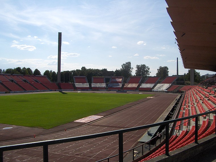
Tampere Stadium
Stadium

Photo: Kallerna, CC BY-SA 4.0.
Tampere Stadium, also known as Ratina Stadium, designed by architect Timo Penttilä and completed in 1965, is a multi-purpose stadium in Tampere, Finland, with a seating capacity of 16,800 people, and up to 32,000 people for concerts. Tampere Stadium is situated 770 metres northwest of Terveyden ja hyvinvoinnin laitos.
Tampere Central Station
Railway station

Photo: Kulmalukko, CC BY-SA 3.0.
Tampere Central Station is a functionalist building in Tampere, Finland, designed by Eero Seppälä and Otto Flodin, completed in 1936. The station is one of the most important railway stations in Finland. Tampere Central Station is situated 1¼ km north of Terveyden ja hyvinvoinnin laitos.
Places in the Area
Nearby places include Viinikka and Ratina.
Viinikka
Suburb

Photo: Methem, Public domain.
Viinikka is a district of Tampere, Finland, located 1,5 kilometers southeast of its city center on the west side of Lake Iides. Its neighboring district is Nekala.
Ratina
Suburb
 Ratina is a district in the center of Tampere, Finland, on the east side of Tammerkoski. The Ratina Stadium, Tampere Bus Station and Tampere's largest shopping mall, the Ratina shopping centre, are located in the district, among others.
Hatanpää
Suburb

Photo: Karri Huhtanen, CC BY-SA 2.0.
Hatanpää is a district in Tampere, Finland, located in the southern part of the city center on the shores of Lake Pyhäjärvi. Hatanpää is actually a peninsula that protrudes towards the lake, leaving the waters of Viinikanlahti Bay to the north and Vihilahti Bay to the south.
Terveyden ja hyvinvoinnin laitos
- Type: Government office
- Address: Hatanpään valtatie 36
- Categories: office and government building
- Location: Tampere, Tampere, Pirkanmaa, Finnish Lakeland, Finland, Nordic countries, Europe
- View on OpenStreetMap
Latitude
61.48647° or 61° 29′ 11″ northLongitude
23.7701° or 23° 46′ 12″ eastOpen location code
9GH5FQPC+H2OpenStreetMap ID
node 11530724063OpenStreetMap feature
office=government
This page is based on OpenStreetMap, Wikidata, and Wikimedia Commons.
We’d love your help improving our open data sources. Thank you for contributing.
Satellite Map
Discover Terveyden ja hyvinvoinnin laitos from above in high-definition satellite imagery.
Notable Places Nearby
Highlights include Tampereen maistraatti and Tampereen verotoimisto.
Nearby Places
Explore places such as Kesko and 36Hatanpää.
Pirkanmaa: Must-Visit Destinations
Delve into Nokia, Valkeakoski, Akaa, and Ylöjärvi.
Curious Government Offices to Discover
Uncover intriguing government offices from every corner of the globe.
About Mapcarta. Data © OpenStreetMap contributors and available under the Open Database License". Text is available under the CC BY-SA 4.0 license, except for photos, directions, and the map. Photo: Kulmalukko, CC BY-SA 4.0.