Smokers Arms
Smokers Arms is a pub in North East Lincolnshire, England which is located on Albion Street. Smokers Arms is situated nearby to the church St Andrew with St Luke & All Saints, as well as near The Salvation Army - Grimsby.| Tap on a place to explore it |
Places of Interest Nearby
Highlights include St Mary’s Church, Grimsby and Grimsby Docks railway station.
St Mary’s Church, Grimsby
Church

Photo: Allan chapman, CC BY-SA 2.0.
St Mary's Church or its full name St Mary on the Sea Church is a Roman Catholic Parish Church in Grimsby, Lincolnshire. It was built from 1880 to 1883. St Mary’s Church, Grimsby is situated 840 feet south of Smokers Arms.
Grimsby Docks railway station
Railway station

Photo: David Wright, CC BY-SA 2.0.
Grimsby Docks railway station serves the Freeman Street area of Grimsby in North East Lincolnshire, England. This is one of the oldest parts of the town, close to the Freeman Street Market and the town's docks both commercial and fish, the railway entrance to both being over the level crossing at the Cleethorpes end. Grimsby Docks railway station is situated 1,900 feet northwest of Smokers Arms.
New Clee railway station
Railway station

Photo: John Beal, CC BY-SA 2.0.
New Clee railway station serves the suburb of New Clee, Grimsby in North East Lincolnshire, England. The station originally had two platforms, since reduced to one and is served by trains on the Barton line between Cleethorpes and Barton-Upon-Humber, operated by East Midlands Railway. New Clee railway station is situated 2,600 feet northeast of Smokers Arms.
Places in the Area
Nearby places include Grimsby and Old Clee.
Grimsby

Photo: Gunnar Larsson, CC BY-SA 3.0.
Grimsby is a fishing port in Lincolnshire, standing on the south bank of the mouth of the River Humber, with a population in 2021 of 86,000. It merges into the seaside town of Cleethorpes, and this conurbation and rural hinterland comprise the unitary Local Authority of North East Lincolnshire, also called Great Grimsby.
Old Clee
Village
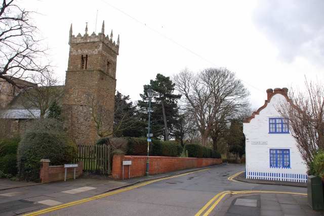
Photo: Allan chapman, CC BY-SA 2.0.
Old Clee is located in the Clee Road and Carr Lane area of eastern Grimsby, North East Lincolnshire, England, and adjoins the neighbouring town of Cleethorpes, to which it has historic links.
Cleethorpes

Photo: Jpacarter, CC BY-SA 3.0.
Cleethorpes is a seaside resort on the Lincolnshire coast of England, south bank of the estuary of the River Humber, with a population in 2021 of 30,000.
Smokers Arms
- Type: Pub
- Address: 175 Albion Street, Grimsby, DN32 7DX
- Location: North East Lincolnshire, England, United Kingdom, Britain and Ireland, Europe
- View on OpenStreetMap
Latitude
53.5701° or 53° 34′ 12″ northLongitude
-0.0702° or 0° 4′ 13″ westOpen location code
9C5XHWCH+2WOpenStreetMap ID
node 11589752173OpenStreetMap feature
amenity=pub
This page is based on OpenStreetMap, Wikidata, and Wikimedia Commons.
We’d love your help improving our open data sources. Thank you for contributing.
Satellite Map
Discover Smokers Arms from above in high-definition satellite imagery.
Notable Places Nearby
Highlights include St Andrew with St Luke & All Saints and The Salvation Army - Grimsby.
Nearby Places
Explore places such as Elliott House and Savoy Tyres.
England: Must-Visit Destinations
Delve into London, Manchester, Sheffield, and Leeds.
Curious Pubs to Discover
Uncover intriguing pubs from every corner of the globe.
About Mapcarta. Data © OpenStreetMap contributors and available under the Open Database License". Text is available under the CC BY-SA 4.0 license, except for photos, directions, and the map. Photo: sidibousaid, CC BY 2.0.