Orme fossili di dinosauro Eubrontes su masso
Orme fossili di dinosauro Eubrontes su masso is in Trentino-Alto Adige, Northeast Italy. Orme fossili di dinosauro Eubrontes su masso is situated nearby to the church Maria Ausiliatrice, as well as near the mountain saddle 1..| Tap on a place to explore it |
Places of Interest Nearby
Highlights include Tre Cime di Lavaredo and Große Zinne.
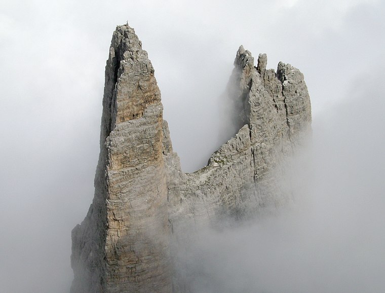
Tre Cime di Lavaredo

Photo: Maurizio Ceol, CC BY 3.0.
The Tre Cime di Lavaredo, also called the Drei Zinnen; ), are three distinctive battlement-like peaks, in the Sexten Dolomites of northeastern Italy. They are one of the best-known mountain groups in the Alps. Tre Cime di Lavaredo is situated 750 metres northwest of Orme fossili di dinosauro Eubrontes su masso.

Places in the Area
Nearby places include Misurina and Fischlein Valley.
Misurina
Hamlet

Photo: Pavel Špindler, CC BY 3.0.
Misurina is a hamlet, which is situated 6 km southwest of Orme fossili di dinosauro Eubrontes su masso.
Fischlein Valley
Hamlet

Photo: Francesco Laffi, CC BY-SA 3.0.
Fischlein Valley is a hamlet, which is situated 7 km northeast of Orme fossili di dinosauro Eubrontes su masso.
Schluderbach
Hamlet

Photo: Llorenzi, CC BY-SA 3.0.
Schluderbach is a settlement in the municipality of Toblach in South Tyrol, Italy, until 1918 part of the Austro-Hungarian County of Tyrol. It is largely a holiday village. Schluderbach is situated 7 km west of Orme fossili di dinosauro Eubrontes su masso.
Orme fossili di dinosauro Eubrontes su masso
- Type: Tourist attraction
- Category: tourism
- Location: Trentino-Alto Adige, Northeast Italy, Italy, Europe
- View on OpenStreetMap
Latitude
46.61364° or 46° 36′ 49″ northLongitude
12.30627° or 12° 18′ 23″ eastOpen location code
8FRJJ874+FGOpenStreetMap ID
node 11626178399OpenStreetMap feature
tourism=attraction
This page is based on OpenStreetMap, Wikidata, and Wikimedia Commons.
We’d love your help improving our open data sources. Thank you for contributing.
Satellite Map
Discover Orme fossili di dinosauro Eubrontes su masso from above in high-definition satellite imagery.
Notable Places Nearby
Highlights include Maria Ausiliatrice and 1..
Nearby Places
Explore places such as Paul Grohmann and Parcheggio Rifugio Auronzo (P4).
Trentino-Alto Adige: Must-Visit Destinations
Delve into Bolzano, Trento, Brixen, and Merano.
Curious Places to Discover
Uncover intriguing places from every corner of the globe.
About Mapcarta. Data © OpenStreetMap contributors and available under the Open Database License". Text is available under the CC BY-SA 4.0 license, except for photos, directions, and the map. Photo: Wikimedia, CC BY-SA 3.0.