Kinder- und Jugendcafé Hope
Kinder- und Jugendcafé Hope is a community center in Kleve, Düsseldorf, North Rhine-Westphalia which is located on Kalkarer Straße. Kinder- und Jugendcafé Hope is situated nearby to the river Spoy, as well as near the theater building Stadthalle Kleve.| Tap on a place to explore it |
Places of Interest Nearby
Highlights include Kleve station and Museum B.C. Koekkoek-Haus.
Kleve station
Railway station

Photo: Stefan Geertsen, CC BY 2.0.
Kleve is a railway station in the town of Kleve, North Rhine Westphalia, Germany. The station opened on 5 March 1863 on the Lower Left Rhine Railway. The train services are operated by NordWestBahn. Kleve station is situated 260 metres northeast of Kinder- und Jugendcafé Hope.
Museum B.C. Koekkoek-Haus
Museum
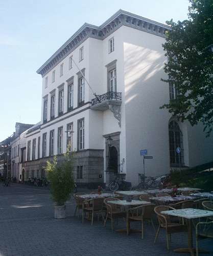
Photo: Wikimedia, CC BY-SA 3.0.
Museum B.C. Koekkoek-Haus is situated 470 metres northwest of Kinder- und Jugendcafé Hope.
Stiftskirche
Church

Photo: Alexostrov, CC BY-SA 3.0.
Stiftskirche is a church, which is situated 580 metres southwest of Kinder- und Jugendcafé Hope.
Places in the Area
Nearby places include Rindern and Qualburg.
Rindern
Village
Rindern is a village in the Kleve of Lower Rhine region of Germany. It is part of the town Kleve. Rindern is situated 2½ km northwest of Kinder- und Jugendcafé Hope.
Qualburg
Village
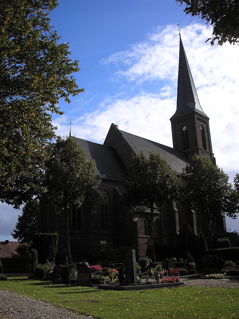
Photo: MiraculixHB, Public domain.
Qualburg is a village, which is situated 3 km southeast of Kinder- und Jugendcafé Hope.
Donsbrüggen
Village

Photo: Vdegroot, CC BY-SA 4.0.
Donsbrüggen is a village in the municipality of Kleve, Kreis Kleve in the German State of North Rhine-Westphalia, with some 1,500 current residents. Donsbrüggen is situated 3½ km northwest of Kinder- und Jugendcafé Hope.
Kinder- und Jugendcafé Hope
- Type: Community center
- Address: Kalkarer Straße 2, Kleve, 47533
- Location: Kleve, Kleve, Düsseldorf, Lower Rhine, North Rhine-Westphalia, Germany, Central Europe, Europe
- View on OpenStreetMap
Latitude
51.7878° or 51° 47′ 16″ northLongitude
6.14361° or 6° 8′ 37″ eastOpen location code
9F38Q4QV+4COpenStreetMap ID
node 11690574080OpenStreetMap feature
amenity=community_centre
This page is based on OpenStreetMap, Wikidata, and Wikimedia Commons.
We’d love your help improving our open data sources. Thank you for contributing.
Satellite Map
Discover Kinder- und Jugendcafé Hope from above in high-definition satellite imagery.
Notable Places Nearby
Highlights include Spoy and Stadthalle Kleve.
Nearby Places
Explore places such as Kalkarer Straße and Bosch Service Beyerinck GmbH.
Lower Rhine: Must-Visit Destinations
Delve into Düsseldorf, Mönchengladbach, Krefeld, and Neuss.
Curious Community Centers to Discover
Uncover intriguing community centers from every corner of the globe.
About Mapcarta. Data © OpenStreetMap contributors and available under the Open Database License". Text is available under the CC BY-SA 4.0 license, except for photos, directions, and the map. Photo: Orange2000, CC BY-SA 4.0.