Pedro Lagos / Chiloé
Pedro Lagos / Chiloé is a bus stop in Central Santiago, Santiago province, Santiago Metropolitan. Pedro Lagos / Chiloé is situated nearby to the police station 4 Comisaría de Santiago Suboficial Mayor Daniel Palma Yáñez, as well as near the government office CRS Santiago Sur 1.| Tap on a place to explore it |
Places of Interest Nearby
Highlights include San Borja Arriarán Hospital and Asilo de las Hermanitas de los Pobres de Santiago.
San Borja Arriarán Hospital
Hospital

Photo: Ninovolador, CC0.
San Borja Arriarán Hospital is situated 690 metres northeast of Pedro Lagos / Chiloé.
Asilo de las Hermanitas de los Pobres de Santiago
Historic building

Photo: Carlos yo, CC BY-SA 4.0.
Asilo de las Hermanitas de los Pobres de Santiago is a historic building, which is situated 1 km northeast of Pedro Lagos / Chiloé.
O’Higgins Park
Park
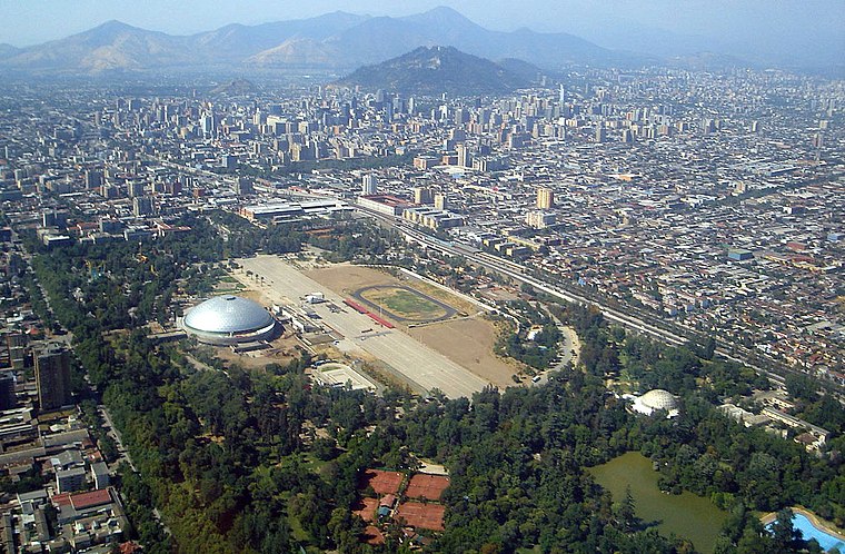 O'Higgins Park, covering approximately 75 hectares, is Santiago, Chile's second largest public park after Metropolitan Park. It is situated in the center of the capital city, within the Santiago Commune.
Places in the Area
Nearby places include Barrio Victoria and Barrio Matta Sur.


Pedro Lagos / Chiloé
- Type: Bus stop
- Category: transportation
- Location: Central Santiago, Santiago province, Santiago Metropolitan, Chile, South America
- View on OpenStreetMap
Latitude
-33.46618° or 33° 27′ 58″ southLongitude
-70.64548° or 70° 38′ 44″ westOpen location code
47RFG9M3+GROpenStreetMap ID
node 1175386275OpenStreetMap feature
highway=bus_stopOpenStreetMap feature
public_transport=platform
This page is based on OpenStreetMap, Wikidata, and Wikimedia Commons.
We’d love your help improving our open data sources. Thank you for contributing.
Satellite Map
Discover Pedro Lagos / Chiloé from above in high-definition satellite imagery.
Notable Places Nearby
Highlights include 4 Comisaría de Santiago Suboficial Mayor Daniel Palma Yáñez and CRS Santiago Sur 1.
Nearby Places
Explore places such as Hojalatería and Parada 1 / Victoria - San Francisco.
Chile: Must-Visit Destinations
Delve into Central Chile, Santiago, Valparaíso, and Concepción.
Curious Bus Stops to Discover
Uncover intriguing bus stops from every corner of the globe.
About Mapcarta. Data © OpenStreetMap contributors and available under the Open Database License". Text is available under the CC BY-SA 4.0 license, except for photos, directions, and the map. Photo: Wikimedia, CC0.