Treat Norwich
Treat Norwich is in Norwich District, Norfolk, England. Treat Norwich is situated nearby to Christ Church, as well as near Sewell Park.| Tap on a place to explore it |
Places of Interest Nearby
Highlights include Christ Church and Sewell Park.

Sewell Park
Park

Photo: C1self, CC BY-SA 3.0.
Sewell Park is a triangular park between Constitution Hill and St. Clement's Hill in Norwich, Norfolk, England. The park was given to the Norwich Corporation and Norwich City Council as an open space by members of the Sewell family and former mayor Edward Gurney Buxton in 1908. Sewell Park is situated 810 feet north of Treat Norwich.
Norwich Cathedral
Church
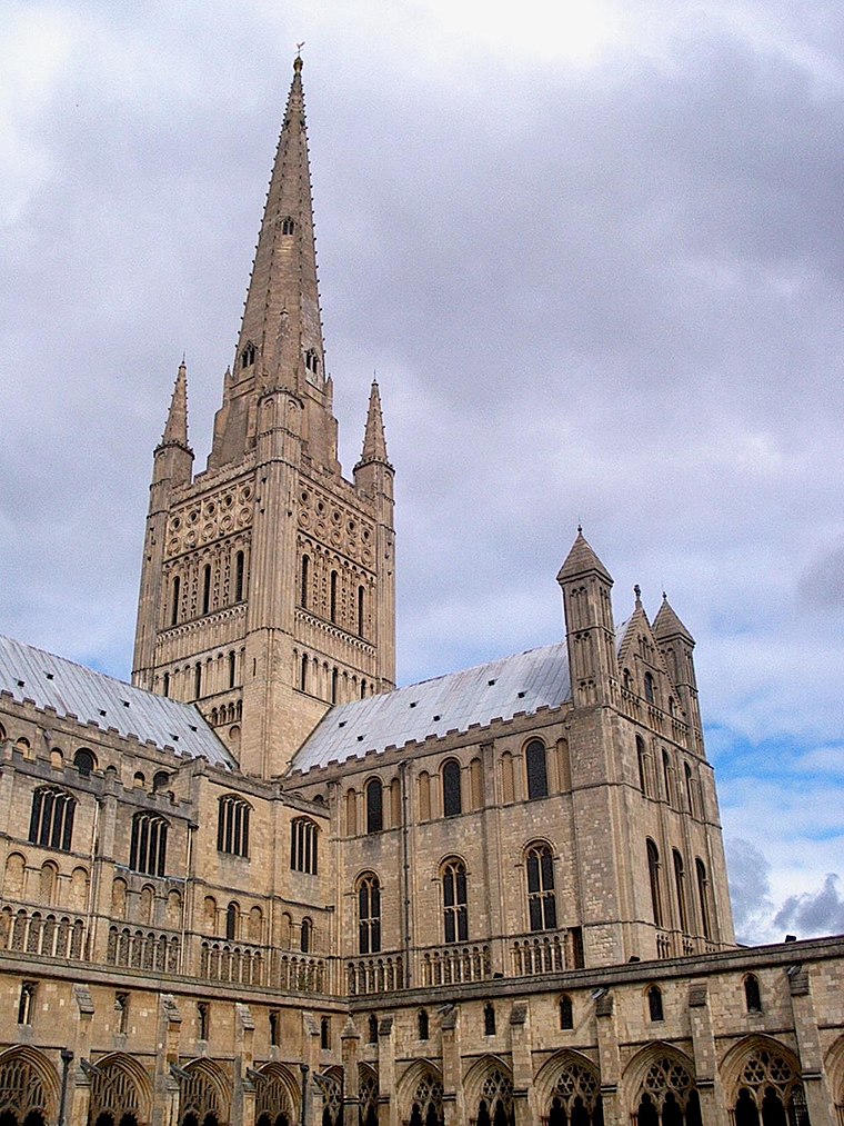
Photo: Aleister Crowley, CC BY-SA 3.0.
Norwich Cathedral, formally the Cathedral Church of the Holy and Undivided Trinity, is a Church of England cathedral in the city of Norwich, Norfolk, England. Norwich Cathedral is situated 4,100 feet south of Treat Norwich.
Places in the Area
Nearby places include Norwich and Mile Cross Estate.
Norwich

Photo: Ashley Dace, CC BY-SA 2.0.
Norwich, a two-cathedral city, is the capital of the English county of Norfolk, within the larger region of East Anglia. It lies some 185 km NNE of London, and as well as being a convenient base for exploring the Broads and the North Norfolk Coast is also…
Mile Cross Estate
Suburb

Photo: Northmetpit, CC0.
Mile Cross Estate is a council estate in Norwich, England. The population of the Mile Cross Ward in Norwich at the 2011 census was 10,655.
Thorpe Hamlet
Suburb
Thorpe Hamlet is a suburb of Norwich, to the east of the city centre, in the Norwich District, in the English county of Norfolk. It was constituted a separate ecclesiastical parish on 9 March 1852, from the civil parish of Old Thorpe, and in 1912, was in the rural deanery of Blofield.
Treat Norwich
- Type: Health care
- Location: Norwich District, Norfolk, East of England, England, United Kingdom, Britain and Ireland, Europe
- View on OpenStreetMap
Latitude
52.64312° or 52° 38′ 35″ northLongitude
1.29737° or 1° 17′ 51″ eastOpen location code
9F43J7VW+6WOpenStreetMap ID
node 11756658833OpenStreetMap feature
healthcare=health_and_wellbeing_clinic
This page is based on OpenStreetMap, Wikidata, and Wikimedia Commons.
We’d love your help improving our open data sources. Thank you for contributing.
Satellite Map
Discover Treat Norwich from above in high-definition satellite imagery.
Notable Places Nearby
Highlights include Angel Road Junior School and Rosebury Road Methodist Church.
Nearby Places
Explore places such as Leslie Terrance plant shop & cafe and The Whalebone.
Norfolk: Must-Visit Destinations
Delve into Norwich, King’s Lynn, Great Yarmouth, and Norfolk Broads.
Curious Places to Discover
Uncover intriguing places from every corner of the globe.
About Mapcarta. Data © OpenStreetMap contributors and available under the Open Database License". Text is available under the CC BY-SA 4.0 license, except for photos, directions, and the map. Photo: matthewhartley369, CC BY-SA 2.0.