Parada / Clínica Dávila
Parada / Clínica Dávila is a bus stop in Independencia, Santiago province, Santiago Metropolitan. Parada / Clínica Dávila is situated nearby to the government office Departamento Postpenitenciario, as well as near CRS Santiago Poniente.| Tap on a place to explore it |
Places of Interest Nearby
Highlights include Clínica Dávila and Chilean National Museum of Fine Arts.
Clínica Dávila
Hospital

Photo: Carlos yo, CC BY-SA 4.0.
Clínica Dávila is a hospital, which is situated 170 metres west of Parada / Clínica Dávila.
Chilean National Museum of Fine Arts
Museum
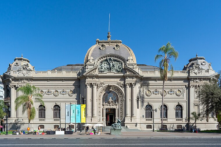
Photo: Carlos yo, CC BY-SA 4.0.
The Chilean National Museum of Fine Arts, located in Santiago, Chile, is one of the major centers for Chilean art and for broader South American art. Established in 1880, the organization is managed by the Artistic Union. Chilean National Museum of Fine Arts is situated 1 km south of Parada / Clínica Dávila.
Museo Histórico Dominico
Museum

Photo: Carlos yo, CC BY-SA 4.0.
Museo Histórico Dominico is a museum, which is situated 320 metres northeast of Parada / Clínica Dávila.
Places in the Area
Nearby places include Barrio Patronato and Independencia.
Barrio Patronato
Neighborhood

Photo: TomasVial, CC BY-SA 3.0.
Barrio Patronato is a traditional neighborhood in Recoleta, Santiago, Chile. It is bounded by Avenida Recoleta from the west, Bellavista Street from the south, Loreto Street from the east, and Dominica street from the north.
Independencia
Suburb

Photo: Carlos yo, CC BY-SA 4.0.
Independencia is a commune of Chile located in Santiago Province, Santiago Metropolitan Region. The commune's main thoroughfare is its namesake Independencia Avenue.
Bellavista and North

Photo: Carlos yo, CC BY-SA 4.0.
The northern part of Santiago starts from Bellavista and ranges out to the city borders in the north comprising the municipalities of Recoleta, Independencia, Renca, Quilicura and Huecuraba.
Parada / Clínica Dávila
- Type: Bus stop
- Category: transportation
- Location: Independencia, Santiago province, Santiago Metropolitan, Chile, South America
- View on OpenStreetMap
Latitude
-33.42738° or 33° 25′ 39″ southLongitude
-70.64633° or 70° 38′ 47″ westOpen location code
47RFH9F3+2FOpenStreetMap ID
node 1175683310OpenStreetMap feature
highway=bus_stopOpenStreetMap feature
public_transport=platform
This page is based on OpenStreetMap, Wikidata, and Wikimedia Commons.
We’d love your help improving our open data sources. Thank you for contributing.
Satellite Map
Discover Parada / Clínica Dávila from above in high-definition satellite imagery.
Places with the Same Name
Discover other places named “Parada / Clínica Dávila”.
Notable Places Nearby
Highlights include CRS Santiago Poniente and Departamento Postpenitenciario.
Nearby Places
Explore places such as Comida el Paso and Barberia.
Chile: Must-Visit Destinations
Delve into Central Chile, Santiago, Valparaíso, and Concepción.
Curious Bus Stops to Discover
Uncover intriguing bus stops from every corner of the globe.
About Mapcarta. Data © OpenStreetMap contributors and available under the Open Database License". Text is available under the CC BY-SA 4.0 license, except for photos, directions, and the map. Photo: Jesus del Toro Garcia, CC BY 2.0.