Harisson Chemist
Harisson Chemist is a pharmacy in Britwell, Borough of Slough, England. Harisson Chemist is situated nearby to Kennedy Park Recreation Ground, as well as near the community center British Parish Community Centre.| Tap on a place to explore it |
Places of Interest Nearby
Highlights include Cocksherd Wood and Burnham railway station.
Cocksherd Wood
Nature reserve

Photo: Dudley Miles, CC BY-SA 4.0.
Cocksherd Wood is a 4.8-hectare Local Nature Reserve in Slough in Berkshire. It is owned by Slough Borough Council and managed by Evergreen 2000. The reserve is known locally as Bluebell Wood.
Burnham railway station
Railway station
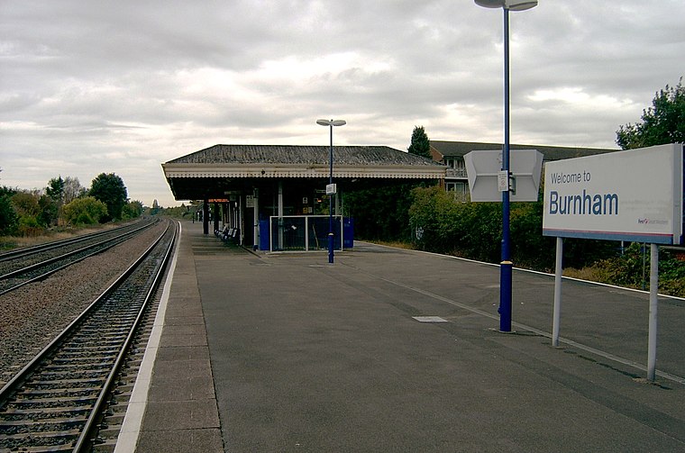
Photo: Cuzza, Public domain.
Burnham railway station is a railway station serving Burnham, Buckinghamshire, England, 20 miles 77 chains from London Paddington and situated between Slough to the east and Taplow to the west. Burnham railway station is situated 1 mile southwest of Harisson Chemist.
Lynch Hill School Primary Academy
School
Lynch Hill Enterprise Academy is a secondary school with academy status which opened in September 2014. The school is located in Slough, in the English county of Berkshire. Lynch Hill School Primary Academy is situated 1,700 feet northwest of Harisson Chemist.
Places in the Area
Nearby places include Britwell and Farnham Royal.
Britwell
Suburb

Photo: Andrew Smith, CC BY-SA 2.0.
Britwell is a residential housing estate and civil parish in the north west of Slough, Berkshire, South East England. It is about 23 miles west of Charing Cross, the centremost point of London.
Farnham Royal
Village

Photo: David Howard, CC BY-SA 2.0.
Farnham Royal is a village and civil parish within Buckinghamshire, England. It is in the south of the county, immediately north of Slough, and around 22 miles west of Charing Cross, Central London.

Harisson Chemist
- Type: Pharmacy
- Categories: health care and shop
- Location: Britwell, Borough of Slough, England, United Kingdom, Britain and Ireland, Europe
- View on OpenStreetMap
Latitude
51.53163° or 51° 31′ 54″ northLongitude
-0.63111° or 0° 37′ 52″ westOpen location code
9C3XG9J9+MHOpenStreetMap ID
node 11756913073OpenStreetMap feature
amenity=pharmacyOpenStreetMap feature
healthcare=pharmacyOpenStreetMap feature
shop=chemist
This page is based on OpenStreetMap, Wikidata, and Wikimedia Commons.
We’d love your help improving our open data sources. Thank you for contributing.
Satellite Map
Discover Harisson Chemist from above in high-definition satellite imagery.
Notable Places Nearby
Highlights include Kennedy Park Recreation Ground and British Parish Community Centre.
Nearby Places
Explore places such as Jodies Tattoos & Salon and Drinks Stop.
England: Must-Visit Destinations
Delve into London, Manchester, Sheffield, and Leeds.
Curious Pharmacies to Discover
Uncover intriguing pharmacies from every corner of the globe.
About Mapcarta. Data © OpenStreetMap contributors and available under the Open Database License". Text is available under the CC BY-SA 4.0 license, except for photos, directions, and the map. Photo: sidibousaid, CC BY 2.0.