Source de Fagnolle
Source de Fagnolle is a spring in Philippeville, Namur, Wallonia. Source de Fagnolle is situated nearby to the church Église Saint-Martin, as well as near Fagnolle Castle.| Tap on a place to explore it |
Places of Interest Nearby
Highlights include Fagnolle Castle and Mariembourg railway station.
Fagnolle Castle

Photo: Jean-Pol GRANDMONT, CC BY 3.0.
Fagnolle Castle is a castle located in the district of Fagnolle, in the municipality of Philippeville, Wallonia, Belgium, and in the Fagne region. The castle was formerly the centre of government of the small independent Barony, later County, of Fagnolle. Fagnolle Castle is situated 740 metres north of Source de Fagnolle.
Mariembourg railway station
Railway station

Photo: Smiley.toerist, CC BY-SA 3.0.
Mariembourg railway station is situated 3 km west of Source de Fagnolle.
Maison des Baillis
Castle
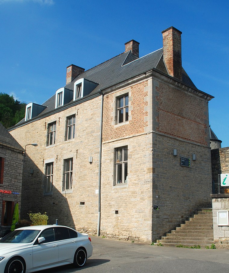
Photo: EmDee, CC BY-SA 3.0.
Maison des Baillis is a castle, which is situated 3½ km southwest of Source de Fagnolle.
Places in the Area
Nearby places include Fagnolle and Dourbes.
Fagnolle
Village

Photo: Jean-Pol GRANDMONT, CC BY 3.0.
Fagnolle is a village of Wallonia and a district of the municipality of Philippeville, located in the province of Namur, Belgium. Fagnolle was a member of the Les Plus Beaux Villages de Wallonie association. until 2020. Fagnolle Castle is located just outside the village.

Mariembourg
Village

Photo: Jean-Pol GRANDMONT, CC BY 2.0.
Mariembourg is a town in the municipality of Couvin in the Province of Namur, Wallonia, Belgium. The town is named after Mary of Hungary, governor of what was then the Habsburg Netherlands, who ordered the construction of a fortress town there in 1542. Mariembourg is situated 3½ km west of Source de Fagnolle.
Source de Fagnolle
- Type: Spring
- Category: body of water
- Location: Philippeville, Arrondissement de Philippeville, Namur, Wallonia, Belgium, Benelux, Europe
- View on OpenStreetMap
Latitude
50.10297° or 50° 6′ 11″ northLongitude
4.56791° or 4° 34′ 5″ eastOpen location code
9F264H39+55OpenStreetMap ID
node 11793741451OpenStreetMap feature
natural=spring
This page is based on OpenStreetMap, Wikidata, and Wikimedia Commons.
We’d love your help improving our open data sources. Thank you for contributing.
Satellite Map
Discover Source de Fagnolle from above in high-definition satellite imagery.
Notable Places Nearby
Highlights include Église Saint-Martin and Réserve naturelle de Dourbes.
Nearby Places
Explore places such as Lavoir Classé and Fagnolle Place.
Curious Springs to Discover
Uncover intriguing springs from every corner of the globe.
About Mapcarta. Data © OpenStreetMap contributors and available under the Open Database License". Text is available under the CC BY-SA 4.0 license, except for photos, directions, and the map. Photo: Zairon, CC BY-SA 4.0.