ETAP - Escola Profissional - Valença
ETAP - Escola Profissional - Valença is a school in Valença, Cristelo Covo e Arão, Valença, Viana do Castelo District which is located on Rua Ibérico Nogueira. ETAP - Escola Profissional - Valença is situated nearby to the park Parque Continente, as well as near the bus station Centro Coordenador de Transportes - Central de Camionagem.| Tap on a place to explore it |
Places of Interest Nearby
Highlights include Museu Ferroviário de Valença and Valença railway station.
Museu Ferroviário de Valença
Museum

Photo: Diego Pino García, CC BY-SA 2.0.
Museu Ferroviário de Valença is a museum, which is situated 400 metres east of ETAP - Escola Profissional - Valença.
Valença railway station
Railway stop

Photo: 8474tim, CC BY-SA 3.0.
Valença railway station is the main railway station of Valença in the Norte Region, Portugal. It mainly serves regional and long-distance traffic towards Porto and northern Portugal, as well as connecting local services across the border to Galicia, Spain. Valença railway station is situated 470 metres east of ETAP - Escola Profissional - Valença.
Fortificações da Praça de Valença do Minho
Historic site
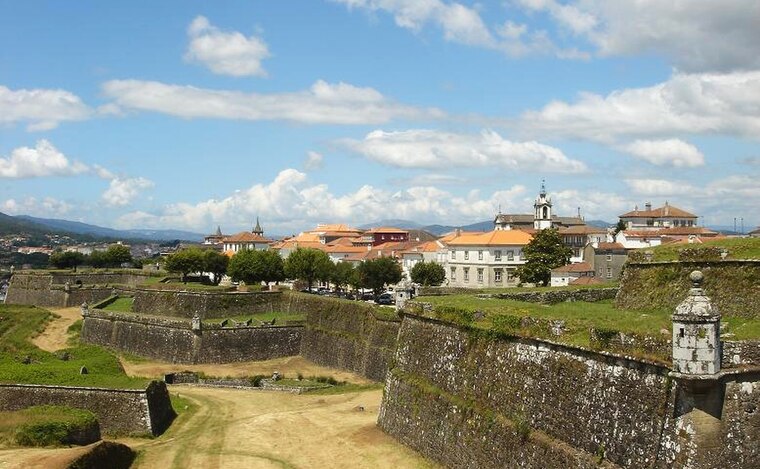
Photo: PQ3, CC BY-SA 3.0.
Fortificações da Praça de Valença do Minho is a historic site, which is situated 770 metres north of ETAP - Escola Profissional - Valença.
Places in the Area
Nearby places include Tui and Ganfei.
Tui

Photo: Lmbuga, CC BY-SA 2.5 es.
Tui is a town in Galicia on the north bank of the Miño River, on the border with Portugal. In Castilian Spanish it's "Tuy" but Galician place names are now the official version.
Ganfei
Village
 Ganfei is a village, which is situated 3½ km northeast of ETAP - Escola Profissional - Valença.
San Bartolomeu
Hamlet

Photo: Wikimedia, CC BY-SA 4.0.
San Bartolomeu is a hamlet, which is situated 3½ km north of ETAP - Escola Profissional - Valença.
ETAP - Escola Profissional - Valença
- Type: School
- Address: Rua Ibérico Nogueira, Valença, 4930-648
- Category: education
- Location: Valença, Cristelo Covo e Arão, Valença, Viana do Castelo District, Portugal, Iberia, Europe
- View on OpenStreetMap
Latitude
42.02339° or 42° 1′ 24″ northLongitude
-8.64477° or 8° 38′ 41″ westOperator
ETAP - Escola ProfissionalOpen location code
8CJH29F4+93OpenStreetMap ID
node 11883399459OpenStreetMap feature
amenity=school
This page is based on OpenStreetMap, Wikidata, and Wikimedia Commons.
We’d love your help improving our open data sources. Thank you for contributing.
Satellite Map
Discover ETAP - Escola Profissional - Valença from above in high-definition satellite imagery.
Notable Places Nearby
Highlights include Parque Continente and Centro Coordenador de Transportes - Central de Camionagem.
Nearby Places
Explore places such as Edifício Europa and Cooperativa Agrícola de Valença.
Portugal: Must-Visit Destinations
Delve into Lisbon, Caldas da Rainha, Porto, and Coimbra.
Curious Schools to Discover
Uncover intriguing schools from every corner of the globe.
About Mapcarta. Data © OpenStreetMap contributors and available under the Open Database License". Text is available under the CC BY-SA 4.0 license, except for photos, directions, and the map. Photo: Sergei Gussev, CC BY 2.0.