Rancho Kyalami
Rancho Kyalami is a hamlet in Tlalpan, Mexico City and has an elevation of 3,204 metres. Rancho Kyalami is situated nearby to the hamlet Rancho Nevado, as well as near Rancho Matamoros.| Tap on a place to explore it |
Places of Interest
Highlights include Ajusco.
Ajusco
Volcano
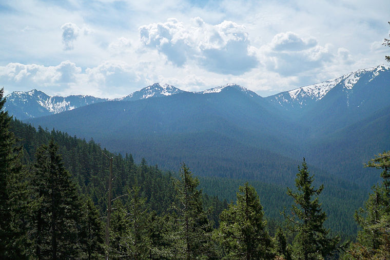 Ajusco is a 3,930 m lava dome volcano located just south of Mexico City, Mexico, in the Tlalpan borough of the city. It is the highest point in the city. Ajusco is situated 2½ km west of Rancho Kyalami.
Places in the Area
Nearby places include San Andrés Totoltepec and Parres El Guarda.
San Andrés Totoltepec
Quarter

Photo: Fotoguia, CC BY-SA 3.0.
San Andrés Totoltepec is a community in the borough of Tlalpan, Mexico City, Mexico. The name contains the Nahuatl elements totol and tepetl. Peterson Schools has its Tlalpan campus in San Andrés Totoltepec. San Andrés Totoltepec is situated 9 km northeast of Rancho Kyalami.
Parres El Guarda
Village

Photo: Sta Ursula Xitla, CC BY-SA 4.0.
Parres El Guarda is a village, which is situated 10 km southeast of Rancho Kyalami.
San Miguel Topilejo
Town
San Miguel Topilejo is a community in the borough of Tlalpan, Mexico City, Mexico. It is one of the eight original villages in Tlalpan. The San Miguel Arcángel temple is in this community. San Miguel Topilejo is situated 10 km east of Rancho Kyalami.
Rancho Kyalami
- Type: Hamlet
- Category: locality
- Location: Tlalpan, Mexico City, Central Mexico, Mexico, North America
- View on OpenStreetMap
Latitude
19.20226° or 19° 12′ 8″ northLongitude
-99.23271° or 99° 13′ 58″ westElevation
3,204 metres (10,512 feet)Open location code
76F26Q28+WWOpenStreetMap ID
node 11885822927OpenStreetMap feature
place=hamlet
This page is based on OpenStreetMap, Wikidata, and Wikimedia Commons.
We’d love your help improving our open data sources. Thank you for contributing.
Satellite Map
Discover Rancho Kyalami from above in high-definition satellite imagery.
Localities in the Area
Explore places such as Rancho Nevado and Rancho Matamoros.
Notable Places Nearby
Highlights include Cerro Mezontepec and Quinta La Divina.
Mexico City: Must-Visit Destinations
Delve into Centro, Xochimilco, Coyoacán, and Condesa and Roma.
Curious Hamlets to Discover
Uncover intriguing hamlets from every corner of the globe.
About Mapcarta. Data © OpenStreetMap contributors and available under the Open Database License". Text is available under the CC BY-SA 4.0 license, except for photos, directions, and the map. Photo: Wikimedia, CC BY-SA 1.0.