Friterie Route 99
Friterie Route 99 is a fast food restaurant in Couvin, Arrondissement de Philippeville, Wallonia. Friterie Route 99 is situated nearby to the chapel Saint-Antoine, as well as near the cemetery Cimetière.| Tap on a place to explore it |
Places of Interest Nearby
Highlights include Neptune Caves and Maison des Baillis.
Neptune Caves
Cave
The Neptune Caves, also known as the Grottes de l'Adugeoir are a series of natural caves located in Wallonia near Petigny in the municipality of Couvin, Belgium. Neptune Caves is situated 2 km west of Friterie Route 99.
Maison des Baillis
Castle
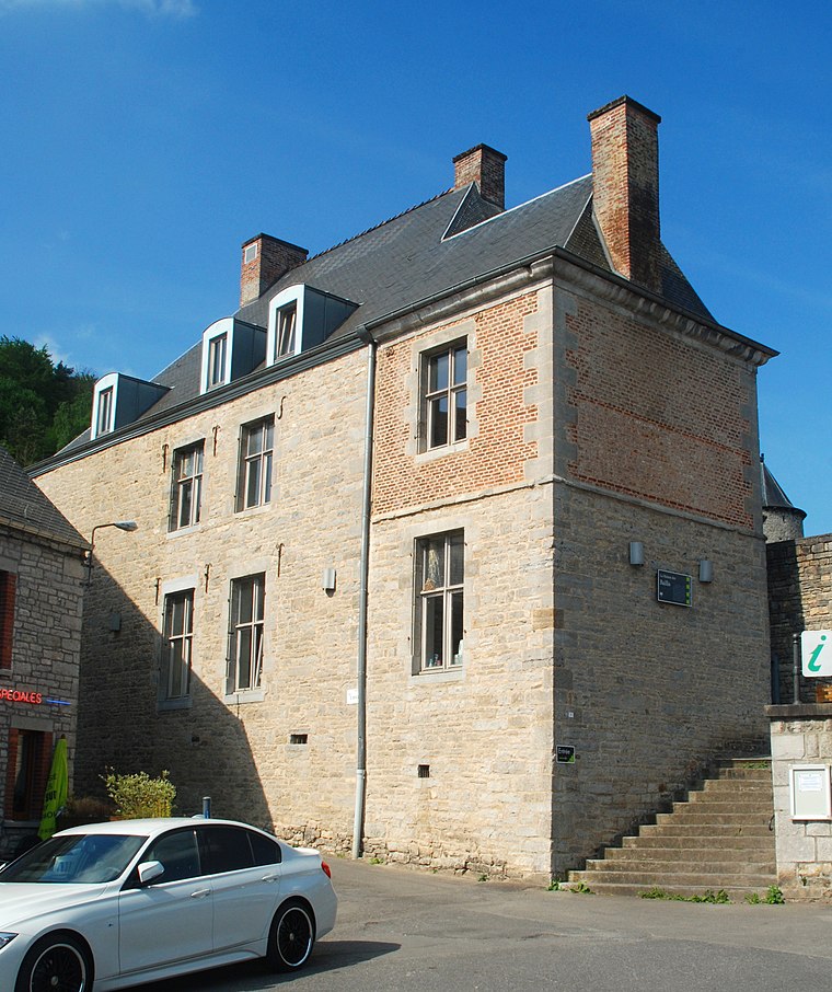
Photo: EmDee, CC BY-SA 3.0.
Maison des Baillis is a castle, which is situated 1½ km northeast of Friterie Route 99.
Fondry des Chiens
Nature reserve

Photo: AardrijkskundeUitgelegd.nl, CC BY-SA 4.0.
Fondry des Chiens is a nature reserve.
Places in the Area
Nearby places include Petigny and Nismes.


Frasnes-lez-Couvin
Village

Photo: 1959jph, CC BY-SA 3.0.
Frasnes-lez-Couvin is a village, which is situated 3 km northwest of Friterie Route 99.
Friterie Route 99
- Type: Fast food restaurant
- Cuisine: friture
- Categories: food and restaurant
- Location: Couvin, Arrondissement de Philippeville, Namur, Wallonia, Belgium, Benelux, Europe
- View on OpenStreetMap
Latitude
50.06157° or 50° 3′ 42″ northLongitude
4.53786° or 4° 32′ 16″ eastOpen location code
9F263G6Q+J4OpenStreetMap ID
node 1189484431OpenStreetMap feature
amenity=fast_foodOpenStreetMap attribute
cuisine=friture
This page is based on OpenStreetMap, Wikidata, and Wikimedia Commons.
We’d love your help improving our open data sources. Thank you for contributing.
Satellite Map
Discover Friterie Route 99 from above in high-definition satellite imagery.
Notable Places Nearby
Highlights include Saint-Antoine and Cimetière.
Nearby Places
Explore places such as Lenoir and Notre-Dame de Bon-Secours.
Curious Fast Food Restaurants to Discover
Uncover intriguing fast food restaurants from every corner of the globe.
About Mapcarta. Data © OpenStreetMap contributors and available under the Open Database License". Text is available under the CC BY-SA 4.0 license, except for photos, directions, and the map. Photo: BUFO88, CC BY-SA 3.0.