Grønnekuld
Grønnekuld is a hill in Bornholm, Capital Region and has an elevation of 117 metres. Grønnekuld is situated nearby to the neighborhood Præstegaden, as well as near Godthåb.| Tap on a place to explore it |
Places of Interest
Highlights include Almindingen and Fru Petersens Café.
Almindingen
 Almindingen is a forest in the centre of the island of Bornholm in Denmark. The forest covers 3,800 hectares, making it Denmark's third largest.
Fru Petersens Café
Café
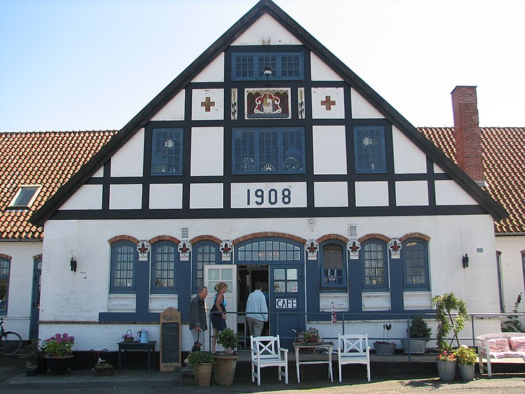
Photo: Rodejong, CC BY-SA 3.0.
Fru Petersens Café is an establishment located along the main road about 1 kilometre west of Østermarie, Bornholm, Denmark, established in 1993.
Østermarie Church
Church

Photo: 7alaskan, CC BY-SA 3.0.
Østermarie Church, in the village of Østermarie near Svaneke on the Danish island of Bornholm, was originally built in the early 13th century. While it was being demolished in 1890, it was discovered it was of considerable architectural interest and work was stopped.
Places in the Area
Nearby places include Aakirkeby and Østermarie.
Aakirkeby

Photo: Lilly M, CC BY-SA 3.0.
Aakirkeby or Åkirkeby is a town in Denmark with a population of 2,091. It is the third largest town on the island of Bornholm in the Baltic Sea. It was the main town of the now abolished Aakirkeby Municipality.
Østermarie
Village

Photo: Ipigott, Public domain.
Østermarie is a village on the Danish island of Bornholm, 8 km west of Svaneke. Founded ca. 1880, its old church, now a ruin, dates back to the 12th century. The population as of 1 January 2025 is 459.
Østerlars
Village

Photo: Beethoven9, CC BY-SA 3.0.
Østerlars is a village in the northeast of the Danish island of Bornholm, 6 kilometres south of Gudhjem and 5 kilometres northwest of Østermarie. It is best known for its round church, the largest on the island. 1. January 2025 it had a population of 254.
Grønnekuld
- Type: Hill with an elevation of 117 metres
- Category: landform
- Location: Bornholm, Capital Region, Denmark, Nordic countries, Europe
- View on OpenStreetMap
Latitude
55.12° or 55° 7′ 12″ northLongitude
14.9674° or 14° 58′ 3″ eastElevation
117 metres (384 feet)Open location code
9F7P4X98+XXOpenStreetMap ID
node 11917415375OpenStreetMap feature
natural=hill
This page is based on OpenStreetMap, Wikidata, and Wikimedia Commons.
We’d love your help improving our open data sources. Thank you for contributing.
Satellite Map
Discover Grønnekuld from above in high-definition satellite imagery.
Localities in the Area
Explore places such as Præstegaden and Godthåb.
Notable Places Nearby
Highlights include Ormekuld and The Bison Forest.
Bornholm: Must-Visit Destinations
Delve into Rønne, Ertholmene, Aakirkeby, and Nexø.
Curious Hills to Discover
Uncover intriguing hills from every corner of the globe.
About Mapcarta. Data © OpenStreetMap contributors and available under the Open Database License". Text is available under the CC BY-SA 4.0 license, except for photos, directions, and the map. Photo: Wikimedia, CC0.