City of San Leandro Fire Station 10
City of San Leandro Fire Station 10 is a fire station in Alameda, California. City of San Leandro Fire Station 10 is situated nearby to the neighborhood Mulford, as well as near the park Garfield Playground.| Tap on a place to explore it |
Places of Interest Nearby
Highlights include Oyster Bay Regional Shoreline and Casa Peralta.
Oyster Bay Regional Shoreline
Park
Oyster Bay Regional Shoreline is a park in San Leandro, California, part of the East Bay Regional Park District. It is located along the eastern shore of San Francisco Bay directly to the south of Oakland International Airport.
Casa Peralta
Historic building
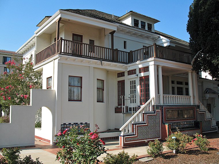
Photo: Sanfranman59, CC BY-SA 3.0.
Casa Peralta is a historic home located at 384 W. Estudillo Ave. in San Leandro, California. The home was built in 1901 by Ludovino Peralta and originally had a Colonial Revival design. Casa Peralta is situated 1½ miles northeast of City of San Leandro Fire Station 10.
San Leandro station
Metro station
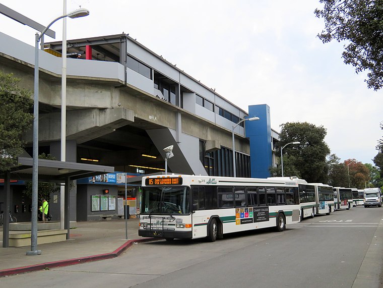
Photo: Pi.1415926535, CC BY-SA 3.0.
San Leandro station is a Bay Area Rapid Transit station located off Davis Street in downtown San Leandro, California. The station has two elevated side platforms, with the faregates at ground level. The station is served by the Orange, Green, and Blue lines. San Leandro station is situated 1½ miles northeast of City of San Leandro Fire Station 10.
Places in the Area
Nearby places include Mulford and Mulford Gardens.
Mulford
Neighborhood
Mulford Landing is a neighborhood in San Leandro in Alameda County, California. Originally known as Wicks Landing, the landing at San Leandro was founded in 1853 by Moses Wicks, Thomas W.
Mulford Gardens
Neighborhood
Mulford Gardens is a neighborhood in San Leandro in Alameda County, California. It lies at an elevation of 20 feet. It was formerly an unincorporated community. It is between Mulford and Mulford Landing.
San Leandro

Photo: Wsiegmund, CC BY-SA 3.0.
San Leandro is a mid-size city of about 90,000 people in the San Francisco Bay Area in Northern California in the United States of America.
City of San Leandro Fire Station 10
- Type: Fire station
- Location: Alameda, California, United States, North America
- View on OpenStreetMap
Latitude
37.70895° or 37° 42′ 32″ northLongitude
-122.18147° or 122° 10′ 53″ westOperator
Alameda County Fire DepartmentOpen location code
849VPR59+HCOpenStreetMap ID
node 11927175890OpenStreetMap feature
amenity=fire_station
This page is based on OpenStreetMap, Wikidata, and Wikimedia Commons.
We’d love your help improving our open data sources. Thank you for contributing.
Satellite Map
Discover City of San Leandro Fire Station 10 from above in high-definition satellite imagery.
Notable Places Nearby
Highlights include Garfield Playground and Mulford Park.
Nearby Places
Explore places such as Williams Street & Doolittle Drive and Williams Street & Doolittle Drive.
California: Must-Visit Destinations
Delve into San Francisco, Los Angeles, San Diego, and Sacramento.
Curious Fire Stations to Discover
Uncover intriguing fire stations from every corner of the globe.
About Mapcarta. Data © OpenStreetMap contributors and available under the Open Database License". Text is available under the CC BY-SA 4.0 license, except for photos, directions, and the map. Photo: Miskatonic, CC BY 2.5.