Empire Tailoring Services
Empire Tailoring Services is a tailor shop in Abingdon-on-Thames, Vale of White Horse District, England. Empire Tailoring Services is situated nearby to Bury Street, as well as near Blue Boar Public House.| Tap on a place to explore it |
Places of Interest Nearby
Highlights include Abingdon Library and Abingdon County Hall Museum.

Abingdon County Hall Museum
Museum
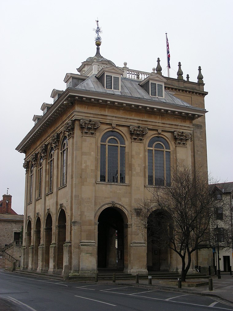
Photo: William M. Connolley, CC BY-SA 3.0.
Abingdon County Hall Museum is a local museum in Abingdon, Oxfordshire, England. The museum is run by Abingdon Town Council and supported by Abingdon Museum Friends, a registered charity. It is a Grade I listed building. Abingdon County Hall Museum is situated 650 feet southeast of Empire Tailoring Services.
St Nicolas Church
Church

Photo: Pam Brophy, CC BY-SA 2.0.
The Church of Saint Nicolas is a Church of England parish church in Abingdon in the English county of Oxfordshire. St Nicolas Church is situated 750 feet southeast of Empire Tailoring Services.
Places in the Area
Nearby places include Caldecott and Shippon.
Caldecott
Suburb
Caldecott is a suburb of Abingdon in Oxfordshire, England. Caldecott was formerly part of Sutton Wick but is now part of Abingdon…
Shippon
Village
Shippon is a village in Oxfordshire, England, 1 mile west of Abingdon. It is the largest village in the civil parish of St. Helen Without, in Vale of White Horse District.
Sutton Pools
Locality

Photo: Bill Nicholls, CC BY-SA 2.0.
Sutton Pools are a picturesque backwater formed by a number of weirs, islands, footbridges and barriers on the course of the River Thames at Sutton Courtenay, Oxfordshire, England. Sutton Pools is situated 1½ miles south of Empire Tailoring Services.
Empire Tailoring Services
- Type: Tailor shop
- Category: shop
- Location: Abingdon-on-Thames, Vale of White Horse District, Oxfordshire, South East England, England, United Kingdom, Britain and Ireland, Europe
- View on OpenStreetMap
Latitude
51.67113° or 51° 40′ 16″ northLongitude
-1.28372° or 1° 17′ 1″ westOpen location code
9C3WMPC8+FGOpenStreetMap ID
node 11936705942OpenStreetMap feature
shop=tailor
This page is based on OpenStreetMap, Wikidata, and Wikimedia Commons.
We’d love your help improving our open data sources. Thank you for contributing.
Satellite Map
Discover Empire Tailoring Services from above in high-definition satellite imagery.
Notable Places Nearby
Highlights include Bury Street and Blue Boar Public House.
Nearby Places
Explore places such as Masons and H&N Nails Bar.
Oxfordshire: Must-Visit Destinations
Delve into Oxford, Banbury, Woodstock, and Henley-on-Thames.
Curious Places to Discover
Uncover intriguing places from every corner of the globe.
About Mapcarta. Data © OpenStreetMap contributors and available under the Open Database License". Text is available under the CC BY-SA 4.0 license, except for photos, directions, and the map. Photo: Andrew Gray, CC BY-SA 3.0.