Woodmans Farm
Woodmans Farm is a farm in West Grinstead, Horsham District, England. Woodmans Farm is situated nearby to the forest Coombewick Furzefield, as well as near Basing Wood.| Tap on a place to explore it |
Places of Interest Nearby
Highlights include Knepp Castle and St James’s Church, Ashurst.
Knepp Castle
Castle

Photo: Richard Nevell, CC BY-SA 4.0.
The medieval Knepp Castle is to the west of the village of West Grinstead, in the parish of Shipley, West Sussex, England near the River Adur and the A24. Knepp Castle is situated 2 miles northeast of Woodmans Farm.
St James’s Church, Ashurst
Church

Photo: Simon Carey, CC BY-SA 2.0.
St James's Church is a Church of England parish church in Ashurst, West Sussex. The church is a grade I listed building and it dates from the early 12th century. St James’s Church, Ashurst is situated 2 miles southeast of Woodmans Farm.
The Parish Church of St Peter and St Paul
Church
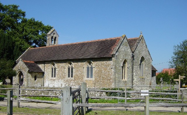
Photo: Janine Forbes, CC BY-SA 2.0.
The Parish Church of St Peter and St Paul is situated 1½ miles southwest of Woodmans Farm.
Places in the Area
Nearby places include Dial Post and Ashington.
Dial Post
Village

Photo: Dave Spicer, CC BY-SA 2.0.
Dial Post is a village in the Horsham District of West Sussex, England. The civil parish, where the lowest level political meetings are held, is West Grinstead in the north-east - its biggest settlement is 2 miles east at Partridge Green.
Ashington
Village
Photo: Janine Forbes, CC BY-SA 2.0.
Ashington is a village and civil parish in the Horsham District of West Sussex, England. It lies on the A24 road 3 miles north-east of Storrington. The parish has a land area of 805 hectares.
Ashurst
Village

Photo: Antiquary, CC BY-SA 4.0.
Ashurst is a village and civil parish in the Horsham District of West Sussex, England, about 2 miles west of Henfield and 11 miles south of Horsham, on the B2135 road. Ashurst is situated 2 miles southeast of Woodmans Farm.
Woodmans Farm
- Type: Farm
- Categories: locality and agriculture
- Location: West Grinstead, Horsham District, West Sussex, South East England, England, United Kingdom, Britain and Ireland, Europe
- View on OpenStreetMap
Latitude
50.94616° or 50° 56′ 46″ northLongitude
-0.36483° or 0° 21′ 53″ westOpen location code
9C2XWJWP+F3OpenStreetMap ID
node 11940608077OpenStreetMap feature
place=farm
This page is based on OpenStreetMap, Wikidata, and Wikimedia Commons.
We’d love your help improving our open data sources. Thank you for contributing.
Satellite Map
Discover Woodmans Farm from above in high-definition satellite imagery.
Notable Places Nearby
Highlights include Coombewick Furzefield and Basing Wood.
Nearby Places
Explore places such as Basing Cottage and Wincaves Farm.
West Sussex: Must-Visit Destinations
Delve into Chichester, Crawley, Worthing, and Horsham.
Curious Farms to Discover
Uncover intriguing farms from every corner of the globe.
About Mapcarta. Data © OpenStreetMap contributors and available under the Open Database License". Text is available under the CC BY-SA 4.0 license, except for photos, directions, and the map. Photo: wildlife encounters, CC BY 2.0.