Gaisbock Feld
Gaisbock Feld is a locality in Eggern, Gmünd District, Lower Austria. Gaisbock Feld is situated nearby to the village Ruders, as well as near the locality Bergäcker.| Tap on a place to explore it |
Places of Interest
Highlights include St. Andreas and Pfarrkirche Gastern.


Schloss Illmau
Castle
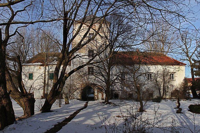
Photo: Duke of W4, CC BY-SA 3.0 at.
Schloss Illmau is a castle, which is situated 4 km northeast of Gaisbock Feld.
Places in the Area
Nearby places include Romava and Eisgarn.
Eisgarn
Village

Photo: Duke of W4, CC BY-SA 3.0.
Eisgarn is a town in the district of Gmünd in the Austrian state of Lower Austria. Eisgarn is situated 7 km west of Gaisbock Feld.
Reingers
Village

Photo: Wikimedia, CC BY 3.0 at.
Reingers is a town in the district of Gmünd in Lower Austria, Austria. Reingers is situated 8 km northwest of Gaisbock Feld.
Gaisbock Feld
- Type: Locality
- Location: Eggern, Gmünd District, Lower Austria, Austria, Central Europe, Europe
- View on OpenStreetMap
Latitude
48.90721° or 48° 54′ 26″ northLongitude
15.20124° or 15° 12′ 5″ eastOpen location code
8FWQW642+VFOpenStreetMap ID
node 11951585571OpenStreetMap feature
place=locality
This page is based on OpenStreetMap, Wikidata, and Wikimedia Commons.
We’d love your help improving our open data sources. Thank you for contributing.
Satellite Map
Discover Gaisbock Feld from above in high-definition satellite imagery.
Localities in the Area
Explore places such as Ruders and Bergäcker.
Notable Places Nearby
Highlights include Badeteich and Standort ehemaliges Schloss Weißenbach.
Lower Austria: Must-Visit Destinations
Delve into St. Pölten, Wiener Neustadt, Klosterneuburg, and Amstetten.
Curious Localities to Discover
Uncover intriguing localities from every corner of the globe.
About Mapcarta. Data © OpenStreetMap contributors and available under the Open Database License". Text is available under the CC BY-SA 4.0 license, except for photos, directions, and the map. Photo: Lonezor, CC BY-SA 3.0.