UTC Bruck an der Leitha
UTC Bruck an der Leitha is in Lower Austria, Austria, and is located on Parkbadstraße. UTC Bruck an der Leitha is situated nearby to the motorhome stopover Camping Harrachpark, as well as near ESV Teichschützen Bruck/Leitha.| Tap on a place to explore it |
Places of Interest Nearby
Highlights include Schloß Prugg and Fire station in Bruck an der Leitha.
Schloß Prugg
Castle

Photo: Bwag, CC BY-SA 4.0.
Schloß Prugg is a castle, which is situated 1 km west of UTC Bruck an der Leitha.
Fire station in Bruck an der Leitha
Fire station

Photo: Wikimedia, CC BY-SA 4.0.
Fire station in Bruck an der Leitha is situated 670 metres northwest of UTC Bruck an der Leitha.
Bruck an der Leitha railway station
Railway station

Photo: Priwo, Public domain.
Bruck an der Leitha railway station is situated 1½ km southwest of UTC Bruck an der Leitha.
Places in the Area
Nearby places include Höflein and Rohrau.
Höflein
Village
Höflein is a town in the district of Bruck an der Leitha in Lower Austria in Austria. Höflein is situated 4½ km north of UTC Bruck an der Leitha.
Rohrau
Village
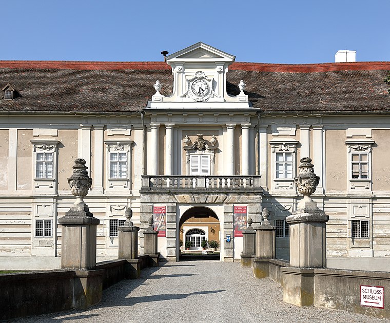
Photo: Bwag, CC BY-SA 4.0.
Rohrau is a village in the state of Lower Austria. The name comes from two German words: Rohr and Au. South of the village is a riparian forest and a swamp covered with reed. Rohrau is situated 6 km northeast of UTC Bruck an der Leitha.
Scharndorf
Village
Scharndorf is a town in the district of Bruck an der Leitha in Lower Austria in Austria. Scharndorf is situated 7 km north of UTC Bruck an der Leitha.
UTC Bruck an der Leitha
- Type: Tennis
- Address: Parkbadstraße 5c, Bruck an der Leitha, 2460
- Category: sports location
- Location: Lower Austria, Austria, Central Europe, Europe
- View on OpenStreetMap
Latitude
48.02812° or 48° 1′ 41″ northLongitude
16.79568° or 16° 47′ 44″ eastOpen location code
8FWR2QHW+67OpenStreetMap ID
node 11964146030OpenStreetMap feature
sport=tennis
This page is based on OpenStreetMap, Wikidata, and Wikimedia Commons.
We’d love your help improving our open data sources. Thank you for contributing.
Satellite Map
Discover UTC Bruck an der Leitha from above in high-definition satellite imagery.
Notable Places Nearby
Highlights include Camping Harrachpark and ESV Teichschützen Bruck/Leitha.
Nearby Places
Explore places such as Lebenshilfe Niederösterreich and Reifen Ritz.
Lower Austria: Must-Visit Destinations
Delve into St. Pölten, Wiener Neustadt, Amstetten, and Klosterneuburg.
Curious Places to Discover
Uncover intriguing places from every corner of the globe.
About Mapcarta. Data © OpenStreetMap contributors and available under the Open Database License". Text is available under the CC BY-SA 4.0 license, except for photos, directions, and the map. Photo: Lonezor, CC BY-SA 3.0.