Avalon Care Home
Avalon Care Home is a social service facility in Gloucester District, Gloucestershire, England. Avalon Care Home is situated nearby to the community center Gloucester Model Railway Club, as well as near Lonsdale Road Methodist Church.| Tap on a place to explore it |
Places of Interest Nearby
Highlights include Church of St Catharine and Gloucestershire Royal Hospital.
Church of St Catharine
Church

Photo: Alby, CC BY-SA 2.0.
Church of St Catharine is situated 1,600 feet northwest of Avalon Care Home.
Gloucestershire Royal Hospital
Hospital
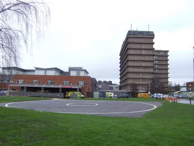
Photo: Jonathan Billinger, CC BY-SA 2.0.
Gloucestershire Royal Hospital is an acute District General Hospital on the Great Western Road in Gloucester operated by the Gloucestershire Hospitals NHS Foundation Trust. Gloucestershire Royal Hospital is situated 2,600 feet west of Avalon Care Home.
Hillfield Gardens, Gloucester
Park

Photo: D Eaketts, CC BY-SA 4.0.
Hillfield Gardens is a public park on London Road, Gloucester, England. It houses several historical monuments. The description in December 2020 stated: "Now a Council-owned public park covering about 1.6 hectares, Highfield Gardens is supported by an active Friends group which organises annual events". Hillfield Gardens, Gloucester is situated 2,200 feet northwest of Avalon Care Home.
Places in the Area
Nearby places include Gloucester and Walham.
Gloucester

Photo: Traveler100, CC BY-SA 4.0.
Gloucester is the county town of Gloucestershire in England's West Country. A major attraction of the city is Gloucester Cathedral, which is the burial place of King Edward II.
Walham
Hamlet
Walham is a hamlet in Longford parish, north of Gloucester, England. It lies on the banks of the River Severn and north of the A40 road. It is a suburb of Gloucester, which is to its south. Walham is situated 1½ miles northwest of Avalon Care Home.
Over
Suburb

Photo: Alby, CC BY-SA 2.0.
Over is a village in Gloucestershire, England, 2 mi west of Gloucester. It lies on the A40 road in the parish of Highnam, on the west bank of the River Severn. Over is situated 2 miles west of Avalon Care Home.
Avalon Care Home
Latitude
51.8672° or 51° 52′ 2″ northLongitude
-2.22119° or 2° 13′ 16″ westOpen location code
9C3VVQ8H+VGOpenStreetMap ID
node 11973819994OpenStreetMap feature
amenity=social_facility
This page is based on OpenStreetMap, Wikidata, and Wikimedia Commons.
We’d love your help improving our open data sources. Thank you for contributing.
Satellite Map
Discover Avalon Care Home from above in high-definition satellite imagery.
Notable Places Nearby
Highlights include Gloucester Model Railway Club and Lonsdale Road Methodist Church.
Nearby Places
Explore places such as Argyll Road and Bohanam House.
Gloucestershire: Must-Visit Destinations
Delve into Gloucester, Cheltenham, Cirencester, and Yate.
Curious Social Service Facilities to Discover
Uncover intriguing social service facilities from every corner of the globe.
About Mapcarta. Data © OpenStreetMap contributors and available under the Open Database License". Text is available under the CC BY-SA 4.0 license, except for photos, directions, and the map. Photo: Matthew Hartley, CC BY-SA 2.0.