Roundabout Row
Roundabout Row is a locality in Romsey, Test Valley District, England. Roundabout Row is situated nearby to the locality The Roadway, as well as near Cow Ladder.| Tap on a place to explore it |
Places of Interest
Highlights include Romsey Abbey and Roke Manor.
Romsey Abbey
Church
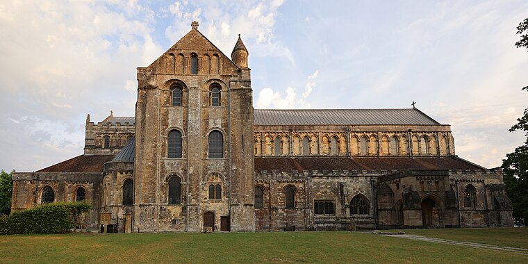
Photo: Wikimedia, CC BY-SA 4.0.
Romsey Abbey is the name currently given to a parish church of the Church of England in Romsey, a market town in Hampshire, England. Until the Dissolution of the Monasteries it was the church of a Benedictine nunnery.
Roke Manor
Manor estate
Roke Manor is a 17th-century manor house approximately 1.2 miles north-west of Romsey in Hampshire, England. The house and 22-acre grounds are the headquarters of Roke Manor Research Ltd, a subsidiary of Chemring Group.
Broadlands
Manor estate

Photo: Wikimedia, CC BY-SA 3.0.
Broadlands is a country house located in the civil parish of Romsey Extra, near the town of Romsey in the Test Valley district of Hampshire, England. Its formal gardens and historic landscape are Grade II* listed on the Register of Historic Parks and Gardens.
Places in the Area
Nearby places include Shootash and Awbridge.
Shootash
Hamlet
Prior to World War I, Shootash was originally an area consisting of a few farmsteads, woodland, and common land which subsequently developed during the 20th century into a small hamlet along the main A27 Romsey to Whiteparish road, lying within the northern boundary of the civil parish of Wellow, in the Test Valley district of Hampshire, England.
Awbridge
Village

Photo: Michael FORD, CC BY-SA 2.0.
Awbridge is a small village and civil parish in the Test Valley district of Hampshire, England, about three miles northwest of Romsey, and near the River Test.
Woodington
Hamlet

Photo: David Martin, CC BY-SA 2.0.
Woodington is a hamlet, which is situated 1½ miles west of Roundabout Row.
Roundabout Row
Latitude
50.98993° or 50° 59′ 24″ northLongitude
-1.52063° or 1° 31′ 14″ westOpen location code
9C2WXFQH+XPOpenStreetMap ID
node 12035777727OpenStreetMap feature
place=locality
This page is based on OpenStreetMap, Wikidata, and Wikimedia Commons.
We’d love your help improving our open data sources. Thank you for contributing.
Satellite Map
Discover Roundabout Row from above in high-definition satellite imagery.
Places with the Same Name
Discover other places named “Roundabout Row”.
Localities in the Area
Explore places such as The Roadway and Cow Ladder.
Notable Places Nearby
Highlights include Marker’s Huts and Pear Tree Close.
Hampshire: Must-Visit Destinations
Delve into Southampton, Portsmouth, Winchester, and Farnborough.
Curious Localities to Discover
Uncover intriguing localities from every corner of the globe.
About Mapcarta. Data © OpenStreetMap contributors and available under the Open Database License". Text is available under the CC BY-SA 4.0 license, except for photos, directions, and the map. Photo: Poliphilo, CC0.