Frog Lane Country Trail
Frog Lane Country Trail is in Balsall, Solihull, England. Frog Lane Country Trail is situated nearby to the forest Squirrel Coppice, as well as near the police station West Midlands Police Dog Training School.| Tap on a place to explore it |
Places of Interest Nearby
Highlights include St. Peter’s and Berkswell railway station.
St. Peter’s
Church

Photo: E Gammie, CC BY-SA 2.0.
St. Peter’s is a church, which is situated 3,500 feet northeast of Frog Lane Country Trail.
Berkswell railway station
Railway station
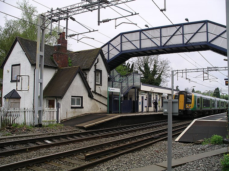
Photo: Snowmanradio, CC BY-SA 4.0.
Berkswell railway station, in the West Midlands of England, takes its name from the nearby village of Berkswell although it is located on the northern edge of the village of Balsall Common. Berkswell railway station is situated 1½ miles northeast of Frog Lane Country Trail.
Heart of England School
School
Heart of England School is a secondary school and sixth form with academy status located in Balsall Common in the West Midlands. Its catchment is the south-east of the Metropolitan Borough of Solihull, primarily rural and commuter villages. Heart of England School is situated 4,000 feet northeast of Frog Lane Country Trail.
Places in the Area
Nearby places include Balsall Common and Temple Balsall.
Balsall Common
Village
Balsall Common is a large village in the Metropolitan Borough of Solihull, West Midlands, England. It is situated 5 miles northwest of Kenilworth, 7 miles west of central Coventry, 7.5 miles east of Solihull and 14 miles to the southeast of Birmingham.
Temple Balsall
Hamlet

Photo: Wikimedia, CC BY-SA 3.0.
Temple Balsall is a village in the civil parish of Balsall, in the Metropolitan Borough of Solihull in the English West Midlands, situated between the large villages of Knowle and Balsall Common.
Barston
Hamlet
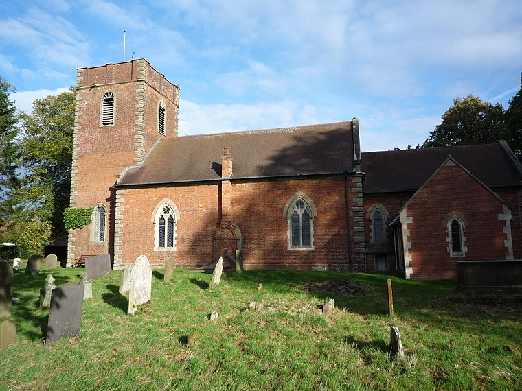
Photo: Oosoom, CC BY-SA 3.0.
Barston is a village and civil parish in Metropolitan Borough of Solihull in the West Midlands of England. It is approximately 4.5 miles east of Solihull and is located inside a large meander of the River Blythe, at the western edge of the Meriden Gap, and midway between the far larger villages of Balsall Common and Hampton-in-Arden. Barston is situated 2 miles northwest of Frog Lane Country Trail.
Frog Lane Country Trail
- Type: Sign
- Categories: information and tourism
- Location: Balsall, Solihull, England, United Kingdom, Britain and Ireland, Europe
- View on OpenStreetMap
Latitude
52.37973° or 52° 22′ 47″ northLongitude
-1.66403° or 1° 39′ 51″ westOperator
Solihull MBCOpen location code
9C4W98HP+V9OpenStreetMap ID
node 12062792556OpenStreetMap feature
tourism=information
This page is based on OpenStreetMap, Wikidata, and Wikimedia Commons.
We’d love your help improving our open data sources. Thank you for contributing.
Satellite Map
Discover Frog Lane Country Trail from above in high-definition satellite imagery.
Places with the Same Name
Discover other places named “Frog Lane Country Trail”.
Notable Places Nearby
Highlights include Squirrel Coppice and West Midlands Police Dog Training School.
Nearby Places
Explore places such as Oaklands Farm and Fern Hill Farm.
England: Must-Visit Destinations
Delve into London, Manchester, Sheffield, and Leeds.
Curious Places to Discover
Uncover intriguing places from every corner of the globe.
About Mapcarta. Data © OpenStreetMap contributors and available under the Open Database License". Text is available under the CC BY-SA 4.0 license, except for photos, directions, and the map. Photo: logopop, CC BY-SA 3.0.