GB Food & Wine
GB Food & Wine is a liquor store in Farnham Royal, South Bucks District, England. GB Food & Wine is situated nearby to Faraday Road Park and Outdoor Gym, as well as near St Anthony’s Catholic Primary School.| Tap on a place to explore it |
Places of Interest Nearby
Highlights include Stoke Park and Slough Museum.
Stoke Park
Manor estate
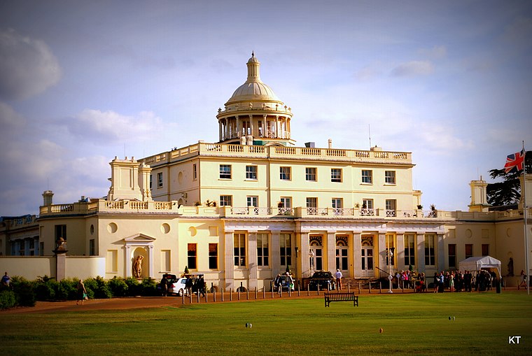
Photo: Carine06, CC BY-SA 2.0.
Stoke Park is a private sporting and leisure estate in Stoke Poges, Buckinghamshire. The mansion building is located in the middle of 300 acres of parkland, lakes, gardens and monuments. Stoke Park is situated 3,700 feet northeast of GB Food & Wine.
Slough Museum
Museum
Slough Museum is an independent museum in Slough in the English county of Berkshire. It had two exhibition galleries presenting the past, present and future of the town. Slough Museum is situated 2,900 feet southwest of GB Food & Wine.
Baylis Court School
School
Baylis Court School is a girls' secondary school with academy status in Slough, Berkshire, England, for students aged 11–18. It is the only single-sex non-selective school in Slough, and has a sixth form which was part of the Herschel Consortium. Baylis Court School is situated 2,400 feet southeast of GB Food & Wine.
Places in the Area
Nearby places include Farnham Royal and Britwell.
Farnham Royal
Village

Photo: David Howard, CC BY-SA 2.0.
Farnham Royal is a village and civil parish within Buckinghamshire, England. It is in the south of the county, immediately north of Slough, and around 22 miles west of Charing Cross, Central London.
Britwell
Suburb

Photo: Andrew Smith, CC BY-SA 2.0.
Britwell is a residential housing estate and civil parish in the north west of Slough, Berkshire, South East England. It is about 23 miles west of Charing Cross, the centremost point of London.

GB Food & Wine
- Type: Liquor store
- Category: shop
- Location: Farnham Royal, South Bucks District, Buckinghamshire, South East England, England, United Kingdom, Britain and Ireland, Europe
- View on OpenStreetMap
Latitude
51.52869° or 51° 31′ 43″ northLongitude
-0.61647° or 0° 36′ 59″ westOpen location code
9C3XG9HM+FCOpenStreetMap ID
node 12064061838OpenStreetMap feature
shop=alcohol
This page is based on OpenStreetMap, Wikidata, and Wikimedia Commons.
We’d love your help improving our open data sources. Thank you for contributing.
Satellite Map
Discover GB Food & Wine from above in high-definition satellite imagery.
Notable Places Nearby
Highlights include Faraday Road Park and Outdoor Gym and St Anthony’s Catholic Primary School.
Nearby Places
Explore places such as JoJo’s and K Pharmacy.
Buckinghamshire: Must-Visit Destinations
Delve into Milton Keynes, Aylesbury, High Wycombe, and Buckingham.
Curious Liquor Stores to Discover
Uncover intriguing liquor stores from every corner of the globe.
About Mapcarta. Data © OpenStreetMap contributors and available under the Open Database License". Text is available under the CC BY-SA 4.0 license, except for photos, directions, and the map. Photo: Wikimedia, CC0.