Greyfriars Road (FG)
Greyfriars Road (FG) is a bus stop in Reading, England. Greyfriars Road (FG) is situated nearby to Greyfriars Church, as well as near the pub The Hope Tap.| Tap on a place to explore it |
Places of Interest Nearby
Highlights include Reading Railway Station and Greyfriars Church.
Reading Railway Station
Railway station
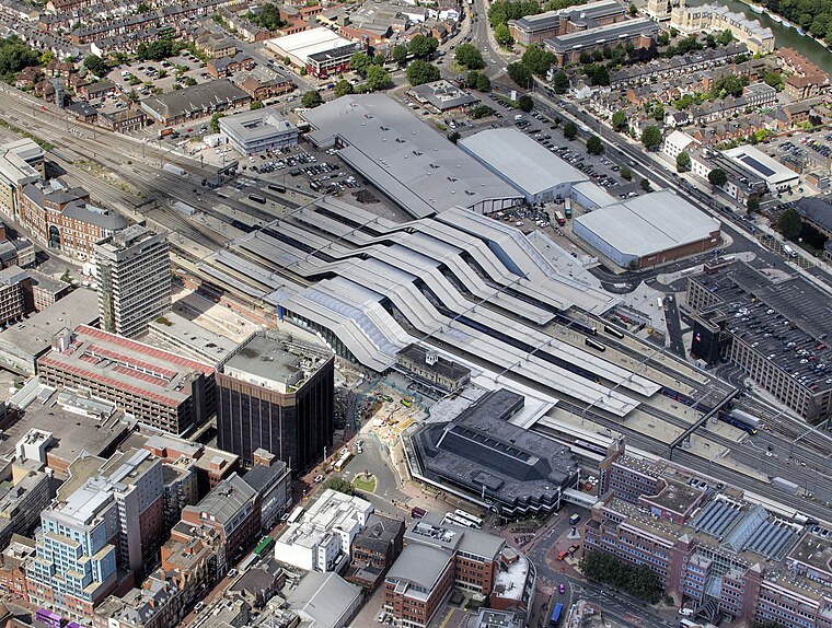
Photo: John Fielding, CC BY 2.0.
Reading railway station is a major transport hub in the town of Reading in Berkshire, England, it is 36 miles west of London Paddington. It is sited on the northern edge of the town centre, near to the main retail and commercial areas and the River Thames. Reading Railway Station is situated 1,200 feet northeast of Greyfriars Road (FG).
Greyfriars Church
Church

Photo: JohnArmagh, Public domain.
Greyfriars Church is an evangelical Anglican church, and former Franciscan friary, in the town centre of Reading in the English county of Berkshire. The church forms part of the Church of England's Diocese of Oxford.
Broad Street Mall
Shopping center

Photo: Bill Nicholls, CC BY-SA 2.0.
Broad Street Mall, previously known as the Butts Centre, is a large indoor shopping centre located in central Reading, England. There is a large multi-storey car park with direct access to the first floor of the centre. Broad Street Mall is situated 830 feet south of Greyfriars Road (FG).
Places in the Area
Nearby places include Coley and Caversham.
Coley
Suburb

Photo: Uli Harder, CC BY-SA 2.0.
Coley is an inner-town district near the centre of the town of Reading, in the English county of Berkshire. It is often referred to as Old Coley, to distinguish it from the adjacent, and much more recent, suburb of Coley Park.
Caversham
Suburb

Photo: Jystyn, Public domain.
Reading is a large, historic town in Berkshire in the South East of England. It is one of the largest towns without city status in the United Kingdom with just under 235,000 inhabitants.
Coley Park
Suburb

Photo: Graham Horn, CC BY-SA 2.0.
Coley Park is a Suburban village to the south of the town of Reading in the English county of Berkshire. It is largely built on the country estate of the same name, surrounding Coley House.
Greyfriars Road (FG)
- Type: Bus stop
- Category: transportation
- Location: Reading, England, United Kingdom, Britain and Ireland, Europe
- View on OpenStreetMap
Latitude
51.45694° or 51° 27′ 25″ northLongitude
-0.97585° or 0° 58′ 33″ westOpen location code
9C3XF24F+QMOpenStreetMap ID
node 12084939723OpenStreetMap feature
highway=bus_stopOpenStreetMap feature
public_transport=platform
This page is based on OpenStreetMap, Wikidata, and Wikimedia Commons.
We’d love your help improving our open data sources. Thank you for contributing.
Satellite Map
Discover Greyfriars Road (FG) from above in high-definition satellite imagery.
Notable Places Nearby
Highlights include The Hope Tap and Sub89.
Nearby Places
Explore places such as Friar Street (FF) and Vachel Court.
England: Must-Visit Destinations
Delve into London, Manchester, Sheffield, and Leeds.
Curious Bus Stops to Discover
Uncover intriguing bus stops from every corner of the globe.
About Mapcarta. Data © OpenStreetMap contributors and available under the Open Database License". Text is available under the CC BY-SA 4.0 license, except for photos, directions, and the map. Photo: Wikimedia, CC BY-SA 2.0.